Granville County, North Carolina
Appearance
Granville County | |
|---|---|
 Granville County Courthouse | |
| Motto: "Combining historic beauty with rich resources for tomorrow" | |
 Location within the U.S. state of North Carolina | |
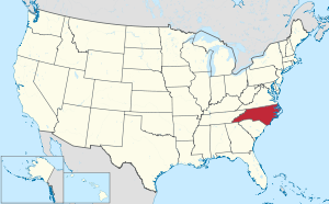
 North Carolina's location within the U.S. | |
| Coordinates: 36°18′00″N 78°39′27″W / 36.299884°N 78.657634°W | |
| Country | |
| State | |
| Established | June 28, 1746 |
| Named for | John Carteret, 2nd Earl Granville |
| Seat | Oxford |
| Largest community | Butner |
| Area | |
| • Total | 537.59 sq mi (1,392.4 km2) |
| • Land | 531.99 sq mi (1,377.8 km2) |
| • Water | 5.60 sq mi (14.5 km2) 1.04% |
| Population (2020) | |
| • Total | 60,992 |
| • Density | 114.65/sq mi (44.27/km2) |
| Congressional district | 4th |
| Website | granvillecounty |
Granville County is a county in the U.S. state of North Carolina. As of 2020, 60,992 people lived there.[1] Its county seat is Oxford.
History
[change | change source]The county was made in 1746 from Edgecombe County.
In 1752 parts of Granville County, Bladen County, and Johnston County were combined to form Orange County. In 1764 the eastern part of Granville County became Bute County. And in 1881 parts of Granville County, Franklin County, and Warren County were combined to form Vance County.
Government
[change | change source]Granville County is part of the Kerr-Tar Regional Council of Governments.
Bordoring Counties
[change | change source]The counties border, or connect to, Granville County:
- Mecklenburg County, Virginia - north
- Vance County, North Carolina - east
- Franklin County, North Carolina - southeast
- Wake County, North Carolina - south
- Durham County, North Carolina - southwest
- Person County, North Carolina - west
- Halifax County, Virginia - north-northwest
Cities and towns
[change | change source]These cities and towns are in Granville County:
References
[change | change source]- ↑ "QuickFacts: Granville County, North Carolina". United States Census Bureau. Retrieved January 18, 2024.

