Harrison County, Indiana
Appearance
Harrison County | |
|---|---|
 Harrison County courthouse in Corydon, built in 1928 | |
 Location within the U.S. state of Indiana | |
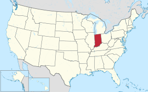
 Indiana's location within the U.S. | |
| Coordinates: 38°12′N 86°07′W / 38.2°N 86.12°W | |
| Country | |
| State | |
| Founded | December 1, 1808 |
| Named for | William Henry Harrison |
| Seat | Corydon |
| Largest city | Corydon |
| Area | |
| • Total | 486.52 sq mi (1,260.1 km2) |
| • Land | 484.52 sq mi (1,254.9 km2) |
| • Water | 2.00 sq mi (5.2 km2) 0.41% |
| Population | |
| • Total | 39,654 |
| • Density | 83.3/sq mi (32.2/km2) |
| Time zone | UTC−5 (Eastern) |
| • Summer (DST) | UTC−4 (EDT) |
| Congressional district | 9th |
| Indiana county #31 Fourth oldest county in state FIPS Code 061[2] | |
Harrison County is a county in the far southern part of the U.S. state of Indiana along the Ohio River. The county was created in 1808. As of 2020, 39,654 people lived there.[1] The county seat is Corydon. Corydon used to be capital of Indiana.[3]
References
[change | change source]- ↑ 1.0 1.1 "QuickFacts: Harrison County, Indiana". United States Census Bureau. Retrieved September 25, 2023.
- ↑ "Harrison County QuickFacts". US Census Bureau. Archived from the original on June 7, 2011. Retrieved September 20, 2011.
- ↑ "Find a County – Harrison County IN". National Association of Counties. Archived from the original on June 14, 2018. Retrieved January 21, 2012.
Other websites
[change | change source]Wikimedia Commons has media related to Harrison County, Indiana.
- Harrison County official website
- Harrison County tourism website
- Registered Harrison County Historic Sites
- Indiana Department of Education, Harrison County Schools
- Watchful Eye of Harrison County