Oxnard, California
Appearance
Oxnard, California | |
|---|---|
|
Clockwise: Channel Islands Harbor; Carnegie Art Museum; hotel at the beach | |
|
| |
| Nickname(s): Gateway to the Channel Islands, The Nard[1] | |
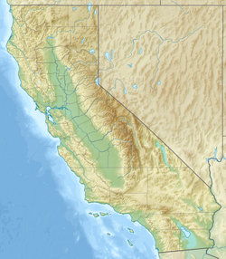
 Location in Ventura County and the state of California | |
| Coordinates: 34°11′29″N 119°10′57″W / 34.19139°N 119.18250°W | |
| Country | United States |
| State | California |
| County | Ventura |
| Region | Oxnard Plain |
| Incorporated | June 30, 1903[2] |
| Named for | Henry T. Oxnard |
| Area | |
| • City | 39.14 sq mi (101.38 km2) |
| • Land | 26.53 sq mi (68.70 km2) |
| • Water | 12.62 sq mi (32.68 km2) 31.41% |
| Elevation | 52 ft (16 m) |
| Population | |
| • City | 202,063 |
| • Rank | 1st in Ventura County 22nd in California 117th in the United States |
| • Density | 7,616.40/sq mi (2,940.71/km2) |
| • Urban | 376,117 (US: 109th) |
| • Urban density | 4,909.7/sq mi (1,895.6/km2) |
| • Metro | 843,843 (US: 71st) |
| Time zone | UTC−8 (Pacific) |
| • Summer (DST) | UTC−7 (PDT) |
| ZIP Codes[6] | 93030–93036 |
| Area codes | 805 and 820 |
| FIPS code | 06-54652 |
| GNIS feature IDs | 1652766, 2411347 |
| Website | www |
Oxnard is the largest city in Ventura County, California. Over 200,000 people live there.[5] Founded in 1903. It is at the western edge of the fertile Oxnard Plain, and is one of the world's most important agricultural places, that has the strawberry and lima bean capital.
References
[change | change source]- ↑ Miller, Stacy (2018-06-19). "Ahhhh, life in the 'Nard…". West Ventura County Business Alliance. Retrieved 2023-01-24.
- ↑ "California Cities by Incorporation Date". California Association of Local Agency Formation Commissions. Archived from the original (Word) on November 3, 2014. Retrieved August 25, 2014.
- ↑ "2019 U.S. Gazetteer Files". United States Census Bureau. Retrieved July 1, 2020.
- ↑ "Oxnard". Geographic Names Information System. United States Geological Survey. Retrieved December 10, 2014.
- ↑ 5.0 5.1 "Oxnard (city) QuickFacts". United States Census Bureau. Retrieved August 24, 2023.
- ↑ "ZIP Code(tm) Lookup". United States Postal Service. Retrieved November 30, 2014.
Other websites
[change | change source]Wikimedia Commons has media related to Oxnard, California.
- City of Oxnard website
- Oxnard @ The Official Conejo Valley Website, a website with local history, events, and community information.


