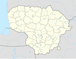
Plungė
Appearance
Plungė | |
|---|---|
City | |
 Plungė Manor | |
| Coordinates: 55°55′N 21°51′E / 55.917°N 21.850°E | |
| Country | |
| Ethnographic region | Samogitia |
| County | Telšiai County |
| Municipality | Plungė district municipality |
| Eldership | Plungė town eldership |
| Capital of | Plungė district municipality Plungė town eldership Plungė rural eldership |
| First mentioned | 1567 |
| Granted city rights | 1792 |
| Population (2015) | |
| • Total | 18,904 (16th) |
| Time zone | UTC+2 (EET) |
| • Summer (DST) | UTC+3 (EEST) |
| Website | http://www.plunge.lt |
Plungė is a city in Lithuania. It has a population of 18,904 people.
Before World War II, Plungė had a large Jewish population.
Twin towns – Sister cities
[change | change source]Plungė is twinned with:
|
|
Wikimedia Commons has media related to Plungė.


