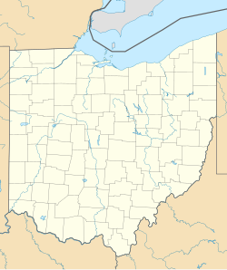
Springfield, Ohio
Appearance
Springfield, Ohio | |
|---|---|
 Buildings along Main Street | |
| Nickname(s): The Home City, The Rose City (City of Roses), The Champion City, The Field | |
 Location within the state of Ohio | |
 Location of Springfield in Clark County | |
| Coordinates: 39°55′37″N 83°48′15″W / 39.92694°N 83.80417°W | |
| Country | United States |
| State | Ohio |
| County | Clark |
| Founded | 1801 |
| Incorporated | 1827 (village) |
| – | 1850 (city) |
| Government | |
| • Type | Council–manager[1] |
| Area | |
| • City | 26.36 sq mi (68.27 km2) |
| • Land | 26.16 sq mi (67.75 km2) |
| • Water | 0.20 sq mi (0.52 km2) |
| Elevation | 978 ft (298 m) |
| Population | |
| • City | 58,662 |
| • Density | 2,242.52/sq mi (865.86/km2) |
| • Metro | 136,001 |
| Time zone | UTC−5 (EST) |
| • Summer (DST) | UTC−4 (EDT) |
| ZIP Codes | 45501–45506 |
| Area code(s) | 937, 326 |
| FIPS code | 39-74118[4] |
| GNIS feature ID | 1065370[5] |
| Website | www |
Springfield is a city in southwestern Ohio. At the 2020 United States Census, 58,662 people lived there.[3] It is the county seat of Clark County.
The city was founded in 1801. It was incorporated in 1827 as a village, and as a city in 1850.
References
[change | change source]- ↑ "Government". City of Springfield, Ohio. Retrieved December 18, 2019.
- ↑ "ArcGIS REST Services Directory". United States Census Bureau. Retrieved September 20, 2022.
- ↑ 3.0 3.1 "QuickFacts: Springfield city, Ohio". United States Census Bureau. Retrieved March 15, 2024.
- ↑ "U.S. Census website". United States Census Bureau. Retrieved January 31, 2008.
- ↑ "US Board on Geographic Names". United States Geological Survey. October 25, 2007. Retrieved January 31, 2008.


