Taching am See
Appearance
Taching a.See | |
|---|---|
 Saint Koloman Church | |
| Coordinates: 47°58′N 12°43′E / 47.967°N 12.717°E | |
| Country | Germany |
| State | Bavaria |
| Admin. region | Oberbayern |
| District | Traunstein |
| Government | |
| • Mayor (2020–26) | Stefanie Lang[1] |
| Area | |
| • Total | 26.76 km2 (10.33 sq mi) |
| Elevation | 478 m (1,568 ft) |
| Population (2022-12-31)[2] | |
| • Total | 2,113 |
| • Density | 79/km2 (200/sq mi) |
| Time zone | UTC+01:00 (CET) |
| • Summer (DST) | UTC+02:00 (CEST) |
| Postal codes | 83373 |
| Dialling codes | 08681 |
| Vehicle registration | TS |
| Website | www |
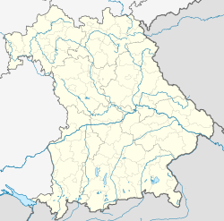
Taching am See is a municipality in Traunstein in Bavaria, Germany. The municipality is to the west and northwest of the Tachinger See (Lake Taching).
The small villages in rural Taching am See are: Assing, Buchberg, Grendach, Gröben, Haunerting, Hörgassing, Hucking, Mauerham, Moosmühle, Obertaching, Planthal, Salling, Schönhofen and Tettenberg.
References
[change | change source]- ↑ Liste der ersten Bürgermeister/Oberbürgermeister in kreisangehörigen Gemeinden, Bayerisches Landesamt für Statistik, 15 July 2021.
- ↑ Genesis Online-Datenbank des Bayerischen Landesamtes für Statistik Tabelle 12411-003r Fortschreibung des Bevölkerungsstandes: Gemeinden, Stichtag (Einwohnerzahlen auf Grundlage des Zensus 2011) .


