Washburn County
Utseende
| Washburn County | |
| County | |
Wisconsin Canoe Heritage Museum
| |
| Land | |
|---|---|
| Delstat | |
| Huvudort | Shell Lake |
| Största stad | Spooner |
| Area | 2 210 km² (2010)[1] |
| - land | 2 065 km² (93%) |
| - vatten | 146 km² (7%) |
| Folkmängd | 15 911 (2010)[2] |
| Befolkningstäthet | 7,7 invånare/km² |
| Grundat | 1883 |
| - uppkallat efter | Cadwallader C. Washburn |
| Tidszon | CST (UTC-6) |
| - sommartid | CDT (UTC-5) |
| FIPS-kod | 55129 |
| Geonames | 5277858 |
 Läge i delstaten Wisconsin.
| |
|
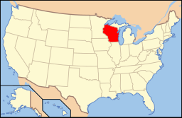
Delstatens läge i USA.
| |
| Webbplats: http://www.co.washburn.wi.us | |
| Fotnoter: Naco - Find a county | |
Washburn County är ett administrativt område i delstaten Wisconsin, USA. År 2010 hade county 15 911 invånare. Den administrativa huvudorten (county seat) är Shell Lake. Countyt har fått sitt namn efter Cadwallader C. Washburn som var Wisconsins guvernör 1872–1874.[3]
Geografi
[redigera | redigera wikitext]Enligt United States Census Bureau har countyt en total area på 2 209 km². 2 097 km² av den arean är land och 112 km² är vatten.
Angränsande countyn
[redigera | redigera wikitext]- Douglas County - nord
- Bayfield County - nordost
- Sawyer County - öst
- Rusk County - sydost
- Barron County - syd
- Burnett County - väst
Källor
[redigera | redigera wikitext]- ^ ”2010 Census U.S. Gazetteer Files for Counties”. U.S. Census Bureau. Arkiverad från originalet den 5 juli 2012. https://www.webcitation.org/68vYLbou5?url=http://www.census.gov/geo/www/gazetteer/files/Gaz_counties_national.txt. Läst 5 juli 2012.
- ^ ”State & County QuickFacts, Washburn County, Wisconsin” (på engelska). U.S. Census Bureau. Arkiverad från originalet den 22 juli 2011. https://www.webcitation.org/60MmEKFYk?url=http://quickfacts.census.gov/qfd/states/55/55129.html. Läst 6 juli 2011.
- ^ ”Washburn, Cadwallader Colden” (på engelska). The Political Graveyard. https://politicalgraveyard.com/bio/warrick-washers.html#070.60.86. Läst 24 september 2021.
| ||||||||||
|


