Papers by Daniel Elliott-esquire
Degradation of polyethylene terephthalate (PET) plastics by the traditional technologies usually ... more Degradation of polyethylene terephthalate (PET) plastics by the traditional technologies usually requires high energy consumption and encounters poor product selectivity. Herein, we report the photoconversion of PET into carbon dioxide with 100% selectivity by in-plane heterostructured NiO/Fe 2 O 3 nanosheets in pure water under normal temperature and pressure. High-resolution transmission electron microscopy, X-ray absorption near-edge spectroscopy and X-ray photoelectron spectra demonstrate the construction of the Z-scheme heterojunction, which can help to accelerate the separation of electron-hole pairs for enhanced PET conversion property. Various in-situ characterization techniques and experiments unveil that PET is photodegraded into carbon dioxide by the photogenerated holes, while oxygen is photoreduced into water by the photoexcited electrons. This work will open new avenues toward resolving the white pollution crisis.

A Cultural Resources Survey for Proposed Olympic Beautification Landscape Enhancement and Street Improvements, Oglethorpe Avenue, Savannah, Georgia, 1994
Degradation of polyethylene terephthalate (PET) plastics by the traditional technologies usually ... more Degradation of polyethylene terephthalate (PET) plastics by the traditional technologies usually requires high energy consumption and encounters poor product selectivity. Herein, we report the photoconversion of PET into carbon dioxide with 100% selectivity by in-plane heterostructured NiO/Fe 2 O 3 nanosheets in pure water under normal temperature and pressure. High-resolution transmission electron microscopy, X-ray absorption near-edge spectroscopy and X-ray photoelectron spectra demonstrate the construction of the Z-scheme heterojunction, which can help to accelerate the separation of electron-hole pairs for enhanced PET conversion property. Various in-situ characterization techniques and experiments unveil that PET is photodegraded into carbon dioxide by the photogenerated holes, while oxygen is photoreduced into water by the photoexcited electrons. This work will open new avenues toward resolving the white pollution crisis.

Atlanta Interagency Archaeological …, 1986
The results of extensive investigations at six prehistoric sites on the upper Savannah River in G... more The results of extensive investigations at six prehistoric sites on the upper Savannah River in Georgia and South Carolina are presented. Two of the sites (Sara's Ridge and Paris Island) had significant, undisturbed deposits dating to the preceramic Late Archaic Period (2,900- 2,700 B.C.). One of these (Sara's Ridge) had evidence of a structure but is interpreted as an extractive camp. The other (Paris Island) had a wide range of artifacts that suggested a more stable residence. Five of the six sites had Early and Middle Woodland components present (700 B.C. - A.D. 500). The intensity of these occupations were generally limited, suggesting nonpermanent settlement. One site (Simpson's Field) was occupied during both the Late Woodland (A.D. 600 - 750) and Late Mississippian (A.D. 1300) Periods. The former occupation yielded Swift Creek and Napier ceramics in numerous features. Finally, Simpson's Field was occupied during the Rembert phase when it served as a small farmstead.
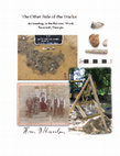
This archaeology project encompasses part of an area known historically as the Railroad Ward, a c... more This archaeology project encompasses part of an area known historically as the Railroad Ward, a community occupied partially by railroad workers and their families during the 19th and 20th centuries, as well as by other blue and white collar workers not associated with the Central of Georgia Railroad. The study area is located in the City of Savannah, in Chatham County, Georgia. It is situated downtown within the boundaries the Central of Georgia Railroad National Historic Landmark District. The people who lived in and around the study area were largely a transient group and not the most prominent citizens of Savannah. Consequently, these people have left only fragmentary glimpses of their lives in the archival record. As a group, they represent the working class, with occupations ranging from common laborer, to more skilled tradesmen. This project examines the lives of individual inhabitants as well as the underground economies, ethnicity, diversity, and evolving demographics on a neighborhood level during the nineteenth and early twentieth centuries. Coastal Heritage Society (CHS) owned then leased the property for construction of a hotel that would extend onto an adjacent parcel not owned by CHS. In spite of the fact that there was no funding for archaeological investigation through the development project or through any city or state revenues, and archaeology was not required by any city ordinance, CHS made the responsible decision to undertake archaeology on its parcel. Unfortunately, neither the landowners, nor the developers, nor the City of Savannah attempted to save the archaeological information contained on the adjacent parcel, much of which is now destroyed.
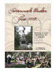
Archeologists with Coastal Heritage Society received a National Park Service, American Battlefiel... more Archeologists with Coastal Heritage Society received a National Park Service, American Battlefield Protection Program Grant in July 2007 for a one year study. The purpose of the project was to locate, identify, and determine the level of preservation of as many archeological sites as possible in the City of Savannah that are related to the October 9, 1779 Battle of Savannah. To achieve these goals archeologists conducted extensive primary document research at repositories in Georgia, Michigan, New York, Pennsylvania, and South Carolina. This research examined text and map documents. The gathered map data was entered into a GIS computer program and then overlaid on a recent digital map of the city. Archeologists used the location of their recent (2005) discovery of the Spring Hill Redoubt as one of the points of alignment between the historic maps and the modern map. Archeologists then analyzed the GIS data to determine which battlefield components appear to fall into modern green spaces owned by the city, such as town squares. Archeologists selected as many of these locations to ground-truth as time and budget allowed. They used a combination of ground penetrating radar, shovel test survey, metal detector survey, and test unit excavation. Areas examined included Madison Square, Lafayette Square, Emmet Park, Colonial Park Cemetery, Cuyler Park, Dixon Park, and Myers Park.
The project was extremely successful. Archeologists located a defensive ditch (almost two meters deep) dug by the British in 1779, defended during the battle, and in-filled by the Americans in 1782. The ditch lies in what is now Madison Square. Brick fragments/rubble in the ditch was part of the brick from the barracks razed by the British less than two weeks before the battle. The brick was used in the defenses around the Central redoubts and was pushed into the British trenches following the British evacuation of the city in 1782. In nearby Lafayette Square, archeologists discovered artifacts that were likely discarded by British soldiers occupying the defensive lines near and in the Central Redoubts, and by civilians associated with the soldiers. Emmet Park revealed a deep (3.5 ft.) feature that may have been constructed as part of the river battery associated with nearby Fort Prevost. Not only did archeologists discover evidence of numerous unmarked graves in Colonial Park Cemetery, but also an anomaly that appears to be one of the ditches running toward a redoubt. Archeologists found no evidence of Revolutionary War activity in Cuyler, Dixon, and Myers parks. These locations were the most tenuous of the GIS data, since they were the farthest from the control points that were used to align the maps. This negative evidence will help reduce the search area for these sites during future investigations. The Savannah Under Fire project greatly expanded the battlefield resources, from one discovered in 2005 to four additional ones this year in areas that few people expected to contain Revolutionary War content. The project not only located and identified these resources, but revealed that they are in an excellent state of preservation. Additionally, the project served to share this exciting information with the public at large, including local residents, tourists, and city, county, and state officials. Numerous partners were involved in the project, with the most extensive in-kind and financial support provided by The LAMAR Institute of Savannah, Georgia. In addition to the promised in-kind match, The LAMAR Institute provided a $4,000 grant to extend fieldwork after the discovery of the extensive deposits in Madison Square.

Savannah Under Fire, 1779: Expanding the Boundaries represents the second phase (2009-2011) in th... more Savannah Under Fire, 1779: Expanding the Boundaries represents the second phase (2009-2011) in the search for
the Revolutionary War Battle of Savannah. The first phase, Savannah Under Fire, 1779: Identifying Savannah’s
Revolutionary War Battlefield was conducted between 2007-2009. Both projects were funded by the National Park
Service American Battlefield Protection Program with grants awarded to Coastal Heritage Society, Savannah, Georgia.
Each incorporated extensive primary document research, geographic information systems (GIS) mapping, shovel test excavation, ground penetrating radar (GPR), test unit excavation, and public outreach.
This report is an addendum to the first project report (Elliott and Elliott 2009) and the reader is referred to it for additional
historical context and results from the first phase of work. The first project’s success was rooted in major discoveries of intact battlefield features. The second project sought to locate additional tangible remains of the battle in order to expand the geographical boundary of the site and provide a foundation for its preservation. In addition, the second phase sought
to expand other boundaries by working with constituencies interested in and/or able to protect the battlefield site and its
many varied components.
The second phase project expanded the existing site boundary 400 yards farther south through the documentation of artifact
collections made several years ago during construction in a key area held by French Reserve Corps. These artifacts, in tandem with the project’s archeological study of the area, indicate that more portions of this part of the battlefield are likely to have survived at that location. This project also identified two key areas of buried A-horizons likely to represent the battlefield landscape. Investigation of twelve target areas in Savannah revealed promise for additional battlefield and period-related resources in two of those locations. The work also served to eliminate geographic areas of site potential, reducing the scope of future searches. The project also successfully shared information from both studies with the general public in a myriad of ways, and produced a 4th and 5th grade curriculum packet.
Both phases of the Savannah Under Fire projects have created an extensive body of information unknown previously. This historical and archeological information holds much promise; the promise of a new understanding of the southern colonies’ role in the American Revolution; of this momentous global event unfolding in the everyday lives of those finding themselves in Savannah in 1779; of the revelation to many today that history survives in our everyday world - one just needs to pick up his feet. But the promise of that history can only be fulfilled if it is protected and if its story is retold in a thousand different media and venues to a thousand different audiences. We are pleased to have produced a compendium
of information that can provide the content for such stories and urge the City of Savannah and its residents to protect
the resources (both newly discovered and those that await discovery) that contribute to these stories. This should be
just the beginning, not the end.

Archaeological Testing of the Fort Howard Tract Effingham County, Georgia, 1986
Sixteen archaeological sites on the Future Development Tract of the Fort Howard Paper Company Pla... more Sixteen archaeological sites on the Future Development Tract of the Fort Howard Paper Company Plant site in Effingham County, Georgia were tested. Methods utilized included shovel tests to determine site boundaries, test units to investigate areas of concentrated occupation to determine if intact cultural features were present, and, in the case of some historic sites, metal detector surveys to help define site boundaries and to locate structural remains. Eleven historic sites, or portions of sites, appear to meet the criteria for nomination to the National Register of Historic Places. Seven of these sites were eighteenth century colonial Salzburger farmsteads and four were nineteenth century farmsteads. These sites produced intact cultural features and all represented relatively undisturbed, single component historic occupations. Prehistoric sites on the tract were found to be badly disturbed. All sites were multiple component, and the components were mixed by natural agents. None of these sites appear to meet the criteria for nomination to the National Register of Historic Places. Components present on the tract included possible Paleoindian; Early and Late Archaic; Early, Middle, and Late Woodland; and Mississippian.
Archaeological Survey for the Landings Development, Chatham County, Georgia, 1985
This report contains the results of an intensive archaeological survey of six small islands, tota... more This report contains the results of an intensive archaeological survey of six small islands, totaling 101 acres, located on the southwestern edge of Skidaway Island in Chatham County, Georgia. The project location is depicted in Figures 1 and 2. This survey was conducted for the Branigar organization by Garrow & Associates as part of "The Landings" residential development. Survey of these portions of the proposed development was requested by the U.S. Army Corps of Engineers. Fieldwork was conducted from 28 October to I November, 1935. Laboratory analysis and report preparation was completed during the following three weeks. The survey methodology consisted of intensive shovel testing with tests placed at 20 meter intervals throughout the project area. A total of 978 shovel tests were dug on the islands with cultural materials recovered from 256 of these tests. Surface reconnaissance of observable artifacts and cultural features was conducted simultaneously. The location of the shovel tests are shown in Figures 3, 4 and 5. Eight archaeological sites were defined and six of these sites were judged to be potentially significant cultural resources eligible for nomination to the National Register of Historic Places. one of these six potentially significant sites, Field Site 1, was situated outside of the immediate project area. Archaeological testing is recommended for the five other potentially significant sites to determine their eligibility for inclusion in the National Register of Historic Places. These include Field Sites 2, 3, 4, 7 and 8. The project vicinity was also identified, primarily through documentary research, as having high potential for containing an intact deposit of Pleistocene vertebrate fossils. Fossil beds of this period are quite rare and few have been investigated using modern scientific techniques. Further archaeological investigation of the Pleistocene aspect of the project area through a project of deep tests aimed at locating potential deposits is recommended. This report is organized in the following manner. Chapter II contains a background review of the project area including a description of the environment. Chapter III provides a description of the research methods used in the field and laboratory. Chapter IV provides a cultural historical framework against which the results of this project can be viewed. The results of the survey finding's are presented in Chapter V. Chapter VI contains an interpretative discussion of the findings with specific comments on the research potential of the project area. Chapter VII contains recommendations for management of the cultural resources identified by this survey project. An Appendix itemizing the materials recovered during the field project is included with this report.
Archaeological Survey and Testing for the Proposed Russell Parkway Extension GDOT Projects Prp-178-1(225) and Mlp-401(156), 1997
This report details the archaeological survey and testing conducted under contract by Southern Re... more This report details the archaeological survey and testing conducted under contract by Southern Research during September and October, 1996 for the Georgia Department of Transportation's proposed Richard B. Russell Parkway Extension (Project PRP-178-1 (225) and MLP-401 (156)) in Houston and Peach counties, Georgia. This research was required for a proposed new roadway. that would link County Road 91 (John Sullivan Road) near County Road 178 (Lakeview Road) in Peach County to the existing Richard Russell Parkway at Houston Lake Road in Houston County (Figure 1). The proposed route extends approximately 15.3 kilometers (9.5 miles) with approximately 4 kilometers (2.5 miles) of access roads or ramps. Survey within the proposed highway corridor yielded seven archeological sites and eight isolated artifact finds. These cultural resources are listed in Table 1. Two sites, 9PE26 AND HT125, were recommended for additional testing following the initial project survey to determine their eligibility for listing on the National Register of Historic Places (NRHP). Both sites, upon testing, were determined to be ineligible for inclusion in the NRHP. Four other sites and three isolated finds were recorded during our study, but these were located outside the proposed project Right of Way (ROW) and will not be impacted by the proposed construction. These cultural resources are listed in Table 2.

Data Recovery at Lovers Lane, Phinizy Swamp and the old Data Sites Bobby Jones Expressway Extension Corridor Augusta, Georgia. Occasional Papers in Cultural Resource Management #7, 1994
The Bobby Jones Expressway Extension Project wi-ll impact three archeological sites, Phinizy Swam... more The Bobby Jones Expressway Extension Project wi-ll impact three archeological sites, Phinizy Swamp (9RI178), Lovers Lane (9R186), and the Old Dike Sites (9R134) and this report details mitigation efforts to recover archaeological data from these sites. Ile project is located in the Savannah River floodplain east of Augusta, Georgia. This project was conducted by Southeastern Archeological Services under contract for the Georgia Department of Transportation. Two of the sites, Phinizy Swamp and Lovers Lane, contained important remains from the Archaic period. Phinizy Swamp contained a stratified deposit of Early and Middle Archaic remains on a relict sand ridge. Shovel tests, test units, and two block excavations were used to investigate this site. Lovers Lane contained an extensive deposit of Late Archaic remains which were deposited within an 800 year period. The stratigraphy at Lovers Lane was quite variable across the site. Systematic shovel tests, eight backhoe trenches, four test units, hand excavated block, and mechanically stripped blocks were used to investigate this site. The Old Dike Site contained an undifferentiated Archaic and nineteenth century historic deposit. Controlled surface collection, systematic shovel tests, two backhoe trenches, three test units were used to investigate this site. Upon excavation this site proved to have limited research value and mitigation efforts were shifted to the other two sites. Geomorphological and sedimentological analysis of the Phinizy Swamp and Lovers Lane environs also was conducted.
Falcon Field and Line Creek: Two Archaic and Woodland Period Sites, 1989
The excavations of two Archaic and Woodland period sites in west-central Georgia are described in... more The excavations of two Archaic and Woodland period sites in west-central Georgia are described in detail. The Line Creek sites, 9Fy36 and 9Fy37, located along the outer fringe of the upper Flint River drainage in Fayette County, Georgia, contain artifacts from a long time span. The excavations were required as a mitigation effort prior to expansion of Peachtree City's Falcon Field Airport. A total of 141 square meters was hand excavated representing the largest archeological examination to date within the Flint River headwaters region. Early, Middle, and Late Archaic and Woodland components were identified within the block, and constitute the primary focus of this study. These data are used to address five questions concerning Archaic lifeways. The Falcon Field site, 9Fy36, yielded the earliest radiocarbon-14 date for soapstone vessels that has been obtained in the Southeast. The Line Creek data are supplemented by a review of research within the Flint River basin.

Archaeological Survey of the Proposed Frederica Yacht Club and Marina, St. Simons Island, Glynn County, 1987
This document reports the results of an archaeological survey of terrestrial portions of the prop... more This document reports the results of an archaeological survey of terrestrial portions of the proposed Frederica Yacht Club and Marina Village development located on the Frederica River, St. Simons Island in Glynn County, Georgia (Figures 1 and 2). This study was conducted by Garrow & Associates, Inc. under contract with the Sea Palms Development Corporation. The survey, which began on October 5, was conducted by a two-person crew and was completed October 9, 1987. Two previous archaeological studies have been conducted for portions of the study area. Honerkamp and Mullins (n.d.) surveyed approximately 250 acres of the Frederica West Development (Bay Colony property) in 1979 and Walker (1984) conducted a backhoe testing investigation to locate remnants of Frederica's southwestern bastion in 1983. This survey examined 11.9 acres including Tract 39 (7.4 acres) and a 4.5 acre portion of Tract 38. The study area is located north of Stevens Road immediately adjacent to the Fort Frederica National Monument property. The project area was heavily forested and necessitated a systematic shovel testing strategy. Shovel tests were placed at 20 m intervals across the tract, and additional tests were excavated at 10 m intervals in order to more accurately define site boundaries. One hundred and thirty-seven shovel tests were excavated, resulting in the definition of four sites on the project area. Site 1 is a portion of eighteenth-century Frederica and is currently listed as a National Monument. Site 1 is clearly eligible for nomination to the National Register of Historic Places. Site 2 contains an historic maritime surface feature (boat slip) and a dispersed scatter of eighteenth or nineteenth century artifacts. Site 3 contains a light scatter of historic architectural refuse of unknown age and function. Sites 2 and 3 are not eligible for nomination to the National Register of Historic Places because of their limited research potential. Site 4 contains undiagnostic oyster shell deposits and historic components and may be eligible for nomination to the National Register.
Archaeological Investigations of City Parking Lot Number 2, Liberty Street Savannah, Georgia, 1999
ard B. Russell Reservoir: The Archaic and Woodland Periods of the Upper Savannah River, 1986
The results of extensive investigations at six prehistoric sites on the upper Savannah River in G... more The results of extensive investigations at six prehistoric sites on the upper Savannah River in Georgia and South Carolina are presented. Two of the sites (Sara's Ridge and Paris Island) had significant, undisturbed deposits dating to the preceramic Late Archaic Period (2,900- 2,700 B.C.). One of these (Sara's Ridge) had evidence of a structure but is interpreted as an extractive camp. The other (Paris Island) had a wide range of artifacts that suggested a more stable residence. Five of the six sites had Early and Middle Woodland components present (700 B.C. - A.D. 500). The intensity of these occupations were generally limited, suggesting nonpermanent settlement. One site (Simpson's Field) was occupied during both the Late Woodland (A.D. 600 - 750) and Late Mississippian (A.D. 1300) Periods. The former occupation yielded Swift Creek and Napier ceramics in numerous features. Finally, Simpson's Field was occupied during the Rembert phase when it served as a small farmstead.

CRM: Vogtle-Effingham-Thalmann 500 kV Electric Transmission Line GP-SN-09: Resource Testing and Data Recovery Planning., 1985
Archaeological testing and data recovery planning studies were conducted within two Designated Wo... more Archaeological testing and data recovery planning studies were conducted within two Designated Work Areas (DWAs) at cultural property GP-S.N.-09, Screven County, Georgia. At each DWA 13 two by two meter test units were excavated to sterile soil. The testing was performed as part of the resource management plan for the proposed Georgia Power Vogtle-Effingham-Thalmann Electric Transmission Line. At the northern DWA (1), the major period of occupation dates to the Late Archaic (4,000 - 1,000 B.C.). Diagnostic hafted bifaces and fiber-tempered ceramics were present as temporal markers. Cultural material of this period was present in two discrete occupation zones recognizable stratigraphically. Artifact clusters are present within each of these zones. These occupations can be interpreted at this point to have been short term habitations established for the purpose of carrying out local resource exploitation. Minor components represented at this DWA date to the Middle-Late Archaic transition, the early Woodland and possibly the Early Archaic. The excavation of one large block excavation is recommended for data recovery within this DWA. The southern DWA (2) was occupied most intensively during the terminal Late Archaic (Thom's Creek) and early Woodland (Refuge-Deptford) periods. Artifacts dating to these periods were concentrated in two different areas, respectively, within the DWA. Diagnostic hafted bifaces and simple stamped and punctate ceramics were associated. It can be suggested that these occupations were in the form of brief, single-episode visits, possibly representing !amps established during resource exploitation forays. minor components recognized date to the Early Archaic, preceramic Late Archaic and possibly the Middle Archaic. The excavation of two small blocks is recommended for data recovery within this DWA. Each block will be located in the area of one of the artifact concentrations.
CRM: Vogtle-Effingham-Thalmann 500 KV Electric Transmission Line GP-SN-08: Data Recovery., 1986
Data Recovery was conducted on a portion of a large archaeological site, designated Cultural Prop... more Data Recovery was conducted on a portion of a large archaeological site, designated Cultural Property GP-SN-08, Designated Work Area #2, located along Brier Creek in Screven County, Georgia during 1985. This work was performed by Garrow & Associates, Inc. for Georgia Power Company as part of the proposed Vogtle-Effingham-Thalmann Electric Transmission Line. This location contained stratified alluvial deposits dating from the Early Archaic Period to recent times. Eighty square meters were excavated in two separate excavation blocks. Human use of the area was characterized by a low diversity of performed tasks throughout prehistory. Intermediate and final stage biface reduction was a major activity conducted in the area. Other activities were indicated from the archaeological record, but the overall interpretation was that of repeated temporary habitation and not a base camp. Activity on Designated Work Area #2 was most intensive during the late-Middle Archaic Period. A Carbon-14 date of 3,790 B.C. +/-90 was obtained for the peak occupation. other components included Early Archaic side-notched and corner-notched traditions, Late Archaic stemmed traditions, Stallings Island Fiber-tempered ceramics, and later Woodland lithic and ceramic materials. The results of the investigations are detailed in this report.
A Cultural Resources Survey for Proposed Olympic Beautification Landscape Enhancement and Street Improvements, Oglethorpe Avenue, Savannah, Georgia, 1994
Garrow & Associates, Inc. conducted a cultural resources survey within two sections of the Ogleth... more Garrow & Associates, Inc. conducted a cultural resources survey within two sections of the Oglethorpe Avenue median in Savannah, Georgia for the City of Savannah during June 1994. The project is within the Savannah National Historic Landmark District (NHLD) (Figure 1). Landscape enhancement and other streetscape improvements are proposed, under a project funded by Interstate Surface Transportation Enhancement Assistance (ISTEA) through the Georgia Department of Transportation (GDOT). The proposed construction requires a prior archaeological assessment survey for the purpose of identifying all historic anPlaces (NRHP), as defined in 36 CFR 800 and 36 CFR 60.4 (HOH Associates, Inc. 1994). Two, archaeological sites, 9CH795 and 9CH796, were defined by the survey. Site 9CH795 is located along the western portion of Oglethorpe Avenue and it contains a mixture of eighteenth-, nineteenth-, and twentieth-century artifacts. The site appears to contain features and buried strata with good integrity, and additional study of this site is recommended. Of particular interest is the eastern end of the site, which probably contains the remains of an eighteenth-century bastion and moat that protected Savannah from invaders during the mid eighteenth century. Archaeological testing is recommended for this site. Site 9CH796 contained a shallow mixed deposit of eighteenth- and nineteenth century artifacts with no potential for intact subsurface deposits. This site retains little integrity and is of minimal interpretive value. No additional work is recommended for this site.
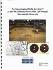
Archaeological Data Recovery at the Waldburg Street Site (9Ch1039) Savannah, Georgia, 2004
The study area is located in urban Savannah, Georgia, which is located on a high marine terrace o... more The study area is located in urban Savannah, Georgia, which is located on a high marine terrace on the Savannah River in Chatham County, approximately 6 miles from the river's mouth (U.S. Department of Agriculture 1974; U.S. Geological Survey 1981). The Waldburg Street site is located on a low ridge in a tract bounded by Wheaton, Ash, and Henry streets, and South Boundary Frontage Road (formerly Bee Street). The study area is currently vegetated in a heavily landscaped maritime hardwood forest with an extensive grass and herbaceous understory. Public housing that previously covered the area has been razed and much of the rubble removed. Most of the utility lines that previously served the area have been disconnected. A series of streets that formerly crossed the study area but are no longer extant include Bolton, Genoa, Mace, and Waldburg streets. The Waldburg Street site, contains a buried deposit of early historic artifacts, midden and features that promises to enlighten our society on early life on the outskirts of Savannah. The potential for important Revolutionary War and Civil War components also was recognized from historical research, although no artifacts or features specifically linked to these events were identified. The Waldburg Street site was deemed eligible for inclusion in the NRHP. After consultation with representatives from the City of Savannah, Southern Research was contracted to prepare this research design for archaeological data recovery at the Waldburg Street site. A more detailed description of the Waldburg Street site is presented later in this research design and in Elliott (2003).


Uploads
Papers by Daniel Elliott-esquire
The project was extremely successful. Archeologists located a defensive ditch (almost two meters deep) dug by the British in 1779, defended during the battle, and in-filled by the Americans in 1782. The ditch lies in what is now Madison Square. Brick fragments/rubble in the ditch was part of the brick from the barracks razed by the British less than two weeks before the battle. The brick was used in the defenses around the Central redoubts and was pushed into the British trenches following the British evacuation of the city in 1782. In nearby Lafayette Square, archeologists discovered artifacts that were likely discarded by British soldiers occupying the defensive lines near and in the Central Redoubts, and by civilians associated with the soldiers. Emmet Park revealed a deep (3.5 ft.) feature that may have been constructed as part of the river battery associated with nearby Fort Prevost. Not only did archeologists discover evidence of numerous unmarked graves in Colonial Park Cemetery, but also an anomaly that appears to be one of the ditches running toward a redoubt. Archeologists found no evidence of Revolutionary War activity in Cuyler, Dixon, and Myers parks. These locations were the most tenuous of the GIS data, since they were the farthest from the control points that were used to align the maps. This negative evidence will help reduce the search area for these sites during future investigations. The Savannah Under Fire project greatly expanded the battlefield resources, from one discovered in 2005 to four additional ones this year in areas that few people expected to contain Revolutionary War content. The project not only located and identified these resources, but revealed that they are in an excellent state of preservation. Additionally, the project served to share this exciting information with the public at large, including local residents, tourists, and city, county, and state officials. Numerous partners were involved in the project, with the most extensive in-kind and financial support provided by The LAMAR Institute of Savannah, Georgia. In addition to the promised in-kind match, The LAMAR Institute provided a $4,000 grant to extend fieldwork after the discovery of the extensive deposits in Madison Square.
the Revolutionary War Battle of Savannah. The first phase, Savannah Under Fire, 1779: Identifying Savannah’s
Revolutionary War Battlefield was conducted between 2007-2009. Both projects were funded by the National Park
Service American Battlefield Protection Program with grants awarded to Coastal Heritage Society, Savannah, Georgia.
Each incorporated extensive primary document research, geographic information systems (GIS) mapping, shovel test excavation, ground penetrating radar (GPR), test unit excavation, and public outreach.
This report is an addendum to the first project report (Elliott and Elliott 2009) and the reader is referred to it for additional
historical context and results from the first phase of work. The first project’s success was rooted in major discoveries of intact battlefield features. The second project sought to locate additional tangible remains of the battle in order to expand the geographical boundary of the site and provide a foundation for its preservation. In addition, the second phase sought
to expand other boundaries by working with constituencies interested in and/or able to protect the battlefield site and its
many varied components.
The second phase project expanded the existing site boundary 400 yards farther south through the documentation of artifact
collections made several years ago during construction in a key area held by French Reserve Corps. These artifacts, in tandem with the project’s archeological study of the area, indicate that more portions of this part of the battlefield are likely to have survived at that location. This project also identified two key areas of buried A-horizons likely to represent the battlefield landscape. Investigation of twelve target areas in Savannah revealed promise for additional battlefield and period-related resources in two of those locations. The work also served to eliminate geographic areas of site potential, reducing the scope of future searches. The project also successfully shared information from both studies with the general public in a myriad of ways, and produced a 4th and 5th grade curriculum packet.
Both phases of the Savannah Under Fire projects have created an extensive body of information unknown previously. This historical and archeological information holds much promise; the promise of a new understanding of the southern colonies’ role in the American Revolution; of this momentous global event unfolding in the everyday lives of those finding themselves in Savannah in 1779; of the revelation to many today that history survives in our everyday world - one just needs to pick up his feet. But the promise of that history can only be fulfilled if it is protected and if its story is retold in a thousand different media and venues to a thousand different audiences. We are pleased to have produced a compendium
of information that can provide the content for such stories and urge the City of Savannah and its residents to protect
the resources (both newly discovered and those that await discovery) that contribute to these stories. This should be
just the beginning, not the end.