Papers by Mahamad Sayab Miya
Journal of Threatened Taxa, 2024
Orthetrum sabina is one of the most common dragonflies found in Nepal, but its feeding behavior h... more Orthetrum sabina is one of the most common dragonflies found in Nepal, but its feeding behavior has not often been reported from there. An example of this species preying on Neurothemis tullia is reported from Maidi Lake, Nepal. This observation was made during a field survey of Odonata using direct observation along transects around the lake. It adds to our knowledge of the species’ feeding behavior, elaborating the previous findings and providing scope for further ecological studies on Odonata.

PeerJ, 2024
Background.
Gaur ( Bos gaurus ) is listed as a vulnerable species in the IUCN Red List of threate... more Background.
Gaur ( Bos gaurus ) is listed as a vulnerable species in the IUCN Red List of threatened species due to the rapid population decline caused by human pressures in their habitats. To develop successful conservation plans, it is essential to understand the relationship between Gaur and their habitats. This study aimed to investigate the factors influencing Gaur habitat use and identify and rank conservation threats in Chitwan National Park, Nepal.
Methods.
Using line transect surveys, we recorded Gaur’s presence via direct sightings and indirect signs (dung, footprints, horns) over an area of 176 km ² in July and August 2022. We used binary logistic regression models to determine the collected ecological and anthropogenic factors influencing the occurrence of Gaur and the relative whole-site threat ranking method to rank conservation threats.
Results.
The results revealed that the probability of Gaur occurrence increases with moderate to high canopy cover, riverine and Shorea robusta dominated forests, and nearest distance to road/path/firelines, while decreasing with the presence of predators. Uncontrolled fire, invasive species, human disturbances, and climate change were ranked as the most prevailing threats to Gaur in our study area. Conservation managers should implement effective habitat management interventions, such as construction of waterhole, firelines maintenance, grassland management, and control of invasive species in the potential habitats, to safeguard and maintain the sustainability of Gaur populations and associated herbivores. Future studies should consider larger geographical settings and multiple seasons, and habitat suitability assessments should be conducted to determine current and future suitable habitat refugia for Gaur and other threatened wildlife species at the landscape level.

Journal of Entomology and Zoology Studies, 2024
Odonata are fascinating and widespread insects considered bioindicators of aquatic ecosystems. Th... more Odonata are fascinating and widespread insects considered bioindicators of aquatic ecosystems. They are studied extensively worldwide. However, limited research has been conducted in various regions of Nepal on Odonata, and there has been no specific study in the Syangja District. Therefore, this study aimed to create a checklist of Odonata explored from Putalibazar and Waling Municipalities of the Syangja District of mid-hills Nepal. Data was collected through direct observation method; along diverse potential habitats such as water bodies, forests, settlements, and agricultural lands. The study documented a total of 33 species of Odonata from 25 genera and eight families. Among these, 20 species were Anisoptera (dragonflies), and 13 were Zygoptera (damselflies). The family Libellulidae had the maximum species richness (N=18), followed by Coenagrionidae (N=5). The study presented only a preliminary checklist of Odonata in the area, suggesting the need for further exploration of the region to discover more species.

PeerJ, 2024
Human-wildlife conflict (HWC) is a pressing issue worldwide but varies by species over time and p... more Human-wildlife conflict (HWC) is a pressing issue worldwide but varies by species over time and place. One of the most prevalent forms of HWC in the mid-hills of Nepal is human-common-leopard conflict (HLC). Leopard attacks, especially in forested areas, can severely impact villagers and their livestock. Information on HLC in the Gorkha district was scarce, thus making it an ideal location to identify high-risk zones and landscape variables associated with such events. Registered cases were collected and reviewed from the Division Forest Office (DFO) during 2019-2021. Claims from DFO records were confirmed with herders and villagers via eight focus group discussions. To enhance modeling success, researchers identified a total of 163 leopard attack locations on livestock, ensuring a minimum distance of at least 100 meters between locations. Using maximum entropy (MaxEnt) and considering 13 environmental variables, we mapped common leopard attack risk zones. True Skill Statistics (TSS) and area under receiver-operator curve (AUC) were used to evaluate and validate the Output. Furthermore, 10 replications, 1,000 maximum iterations, and 1000 background points were employed during modeling. The average AUC value for the model, which was 0.726 ± 0.021, revealed good accuracy. The model performed well, as indicated by a TSS value of 0.61 ± 0.03. Of the total research area (27.92 km ² ), about 74% was designated as a low-risk area, 19% as a medium-risk area, and 7% as a high-risk area. Of the 13 environmental variables, distance to water (25.2%) was the most significant predictor of risk, followed by distance to road (16.2%) and elevation (10.7%). According to response curves, the risk of common leopard is highest in the areas between 1.5 to 2 km distances from the water sources, followed by the closest distance from a road and an elevation of 700 to 800 m. Results suggest that managers and local governments should employ intervention strategies immediately to safeguard rural livelihoods in high-risk areas. Improvements include better design of livestock corrals, insurance, and total compensation of livestock losses. Settlements near roads and water sources should improve the design and construction of pens and cages to prevent livestock loss. More studies on the characteristics of victims are suggested to enhance understanding of common leopard attacks, in addition to landscape variables. Such information can be helpful in formulating the best management practices.
Ceylon Journal of Science, 2024
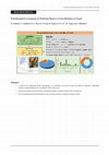
Nepal harbors many ethnomedicinal plants distributed throughout the country’s diverse geography. ... more Nepal harbors many ethnomedicinal plants distributed throughout the country’s diverse geography. It is crucial to document plants’ ethnobotanical knowledge for further research and conservation. This study aimed to conduct a quantitative ethnobotanical analysis of the medicinal plants used in the Varagung Muktichhetra Rural Municipality of Mustang District, Nepal. Data were collected through a household survey (N = 101), using snowball sampling with 40% sampling intensity, 12 Key Informant Interviews (KIIs), and two Focus Group Discussions (FGDs). The data was analyzed using different quantitative tools: Informant consensus factor (Fic), Fidelity Level (FL), and Use Values (UV). A total of 54 medicinal plants belonging to 32 families were documented, which were used to treat 40 different ailments. The family Asteraceae represented the maximum number of plants being used. Herbs were most frequently used (59%), and root (n =10) was the most used plant part. Neopicrorhiza scrophulariiflora was the most frequently used and preferred species (FL = 65% and UV = 0.62). Fever (Fic = 0.88) and gastrointestinal disorder (Fic = 0.86) were the major ailment categories treated. Oral (76%) was the main route of administration of medicines in the body, and the most used form of medicine preparation was paste (46%). Unsustainable harvesting, illegal collection, and forest fire were the major threats to medicinal plants and were highly significant after applying the non-parametric Friedman test. Enactment of a policy that focuses on conservation, sustainable harvesting, and domestication of highly valued medicinal plants is recommended to policymakers.
Journal of Forest and Natural Resource Management, 2023
Scientific forest management (SciFM) was in the initial phase of its implementation and practice ... more Scientific forest management (SciFM) was in the initial phase of its implementation and practice in Nepal. However, it is discontinued due to the conflicting opinions among the forestry stakeholders. This study investigated the SciFM plan preparation process, and the involvement of different stakeholders in the planning, implementation, and capacity enhancement of community forest user groups (CFUGs) in two community forests of the Kaski District, Nepal. For this, we used a household survey (n = 101), key-informant interview (n = 15), and focus group discussion (n = 3). The study found that forest technicians were dominant over users during the SciFM plan preparation process as well as in decision-making. While in the case of implementation, it was
CFUGs, who play a leading role to accomplish most of the activities. During the plan implementation, the higher percentage of involvement of users was in thinning, pruning and weeding activity (50%), followed by social development (20%) and timber-related activities (20%). However, themajority of the respondent considered that SciFM was highly technical and 90% of the respondents could not implement the plan. The forest authority (DFO), the executive committee, and the Federation of
Community Forestry Users Nepal (FECOFUN) were involved in the capacity building of the users to some extent during the planning and implementation of SciFM. The results of this study could be the baseline information for the successful planning and implementation of silviculture-based forest management in other parts of the country.

Nepalese Journal of Zoology, 2023
This study aimed to compare the diversity of birds between protected and non-protected areas that... more This study aimed to compare the diversity of birds between protected and non-protected areas that are similar in climatic and geographical features. The study was carried out in three different habitat types (forest, agricultural land and wetland) of protected Sundarijal and nonprotected Changunarayan areas. Field data were collected using a "Point Count Approach" in transects which were laid in different habitat types (Forest, Agricultural land & Wetland). Shannon-Wiener and Margalef Diversity Indices were used to calculate the diversity of birds and Pielou's Evenness was used to calculate the evenness of bird species. Also, the national and global conservation status of bird species was categorized based on the National Red List Series and IUCN Red List of Threatened Species. The result shows that, a total of 114 species of birds, of which 89 species from the Changunarayan and 80 species from Sundarijal were recorded. The overall Shannon-Weiner diversity, Pielou's evenness, and Margalef's richness index were higher in Changunarayan (H1 = 4.16, E1 = 0.92, and R1 = 12.85) than in Sundarijal (H2 = 3.65, E2 = 0.83, R2 =11.77). Our study has shown the highest Shannon-Weiner Index (H1=3.99) and Margalef's richness index (R1=11.51) in Forest in Changunarayan. However, in Sundarijal, the highest Shannon-Weiner index (H2=3.49) was found in farmland and Margalef's richness index (R2=9.54) was documented highest for the wetland. Among the total recorded species, 109 and 110 species were categorized as least concerned nationally and globally, respectively while 4 globally threatened and 5 nationally threatened species were recorded in our study site. Our study showed that both protected and non-protected areas support the diversity and richness of birds. Hence priority should be given to both areas for the conservation of birds.
International Journal of Zoology, 2023
Information on the spatial and temporal patterns of losses caused by leopard (Panthera pardus) in... more Information on the spatial and temporal patterns of losses caused by leopard (Panthera pardus) in terms of human attacks and livestock depredation in the human-dominated landscape of the mid-hills of Nepal is essential in formulating and implementing efective mitigation measures. Tis study aimed to assess the spatial and temporal patterns of leopard attacks on humans and livestock and the economic losses incurred by livestock depredation between 2015 and 2019 in the Bhanu municipality of Tanahun District. We adopted a household survey (N = 110), key informant (N = 10), and focus group discussion (N = 4) for this study. We purposively chose two confict wards: 2 and 4, based on the severity of the attacks by the leopard. Within each ward, we selected the households randomly and conducted a semistructured questionnaire survey in September 2020. A total of 8 incidents of human attacks and 142 incidents of livestock depredation were recorded, with six human casualties in ward 2 and 1.45 incidents of livestock depredation per household in ward 4. Te maximum attack was observed during 2019 both on humans (n = 6) and livestock (n = 67). Leopards mostly attacked children below 9 years, living within 200 m of the nearest forest edge, with the highest attack during the autumn months (62.5%). During the fve years, leopard killed goats that represent 83.1% of total livestock loss categories. A signifcant diference was found in the frequency of attacks on livestock over the years (χ 2 = 87.60, df = 4, and P ≤ 0.01), months (χ 2 = 16.53, df = 11, and P � 0.12), and time of day (χ 2 = 48.47, df = 3, and P ≤ 0.001) with the highest attack during the year 2019 (47.18%), July (14.08%), and daytime (42.96%), respectively. Households living nearer to the forest edge (<200 m) lost more livestock (72.54%). Te monetary value of a total of 8142 USD (74 USD per household) was lost due to livestock depredation, with major monetary loss at a distance >400 m from the forest edge. We suggest adopting mitigation measures like predator-proof livestock corals while stall feeding and strengthening conscientious livestock herding practices during grazing, encouraging livestock insurance schemes, educating local communities about leopard behavior, caring for and protecting children intensively in the leopard attack sites, improving the prey base in the wild, and timely management of man-eater leopard to reduce the confict in the study area and the country.

Eurasian Journal of Soil Science, 2023
Land Use Land Cover (LULC) Change has emerged as a significant environmental issue and a worry fo... more Land Use Land Cover (LULC) Change has emerged as a significant environmental issue and a worry for the sustainable use of natural resources. This study was performed to determine the rate in change of land cover and its significant impact on springs water in the Ritung Khola sub-watershed of Myagdi district, Nepal, between 2010 and 2020. This study analyzes LULC dynamics and it's impact on springs water using satellite imageries (Landsat 5 TM and Landsat 8 OLI/TIRS) and focus group discussions with the inhabitants. We used Supervised Maximum Likelihood Classification algorithm to classify attributes of the LULC changes. The results demonstrated a significant change in LULC during those ten years (2010-2020). The area covered by agricultural land and human settlements significantly increased by 313.54% and 367.14%, respectively. On the contrary, barren land, water bodies and forest cover have been reduced by 37.52%, 13.16% and 5.26%, respectively. The number of active springs followed decreasing trend as many of them were completely displaced or dried due to erosions and frequent landslides. The findings from this study are expected to facilitate the planning process adopted to prevent springs under the threat of extension and mitigate the water scarcity problem.
Animals, 2023
Rapidly changing environmental conditions (bioclimatic, anthropogenic, topographic, and vegetatio... more Rapidly changing environmental conditions (bioclimatic, anthropogenic, topographic, and vegetation-related variables) are likely to alter the spatial distribution of flora and fauna. To understand the influence of environmental variables on the Blue bull’s distribution and to identify potential conflict zones, the habitat suitability analysis of the Blue bull was performed using ensemble modeling. We modelled the distribution of the Blue bull using an extensive database on the current distribution of the Blue bull and selected 15 ecologically significant environmental variables. We used ten species distribution modeling algorithms available in the BIOMOD2 R package. Among the ten algorithms, the Random Forest, Maxent, and Generalized linear model had the highest mean true skill statistics scores, ensuring better model performance, and were considered for further analysis. We found that 22,462.57 km2 (15.26%) of Nepal is suitable for the Blue bull. Slope, precipitation seasonality, and distance to the road are the environmental variables contributing the most to the distribution of Blue bull. Of the total predicted suitable habitats, 86% lies outside protected areas and 55% overlaps with agricultural land. Thus, we recommend that the future conservation initiatives including appropriate conflict mitigation measures should be prioritized equally in both protected areas and outside protected areas to ensure the species’ survival in the region.

Ceylon Journal of Science, 2023
In Nepal, there had been an attempt to shift forest management practices (from conservation-orien... more In Nepal, there had been an attempt to shift forest management practices (from conservation-oriented to productive forest) via Scientific Forest Management (SciFM) approach; applying an irregular shelterwood system. However, SciFM faced conflicting arguments regarding logging, regeneration capacity, and species diversity. Thus, this study investigated the effects of irregular shelterwood system-based scientific forest management on tree species distribution, diversity, and the regeneration of a Shorea robusta dominated forest in the Kailali district, Nepal. The quadrat method based on simple random sampling was used for vegetation sampling with a total of 20 quadrats for unmanaged blocks and ten quadrats for managed blocks. In each quadrat, the diameter at breast height (DBH) and height of the trees and saplings were measured, while the number of seedlings was counted. Importance Value Index, Diversity indices, Jaccard’s Index, and total regeneration were calculated to compare the dominance, diversity, similarities of species between the blocks, and regeneration status, respectively. Shorea robusta was the most dominant species in managed and unmanaged blocks. Higher species diversity, evenness, and richness were found in unmanaged blocks. However, species dominance, seedling density, and sapling density were higher in managed blocks. The majority of the tree species showed a contagious distribution. There were significant differences in diversity and regeneration status between managed and unmanaged blocks. Therefore, this study supports the implementation of an irregular shelterwood system for the improved regeneration status of valuable species like Shorea robusta to manage the forest sustainably for the future.

Environment and Natural Resources Journal, 2023
Non-timber forest products (NTFPs) contribute to livelihood of rural communities which is influen... more Non-timber forest products (NTFPs) contribute to livelihood of rural communities which is influenced by numerous socioeconomic variables. This study assessed the financial contribution of Zanthoxylum armatum and the influence of respondents' various socioeconomic characteristics on such contribution in Ghatan of Beni Municipality, Myagdi District, Nepal. For this study, we used semi-structured questionnaires to 80 purposively selected households, followed by 10 key informant interviews, four focus group discussions, and direct field observations. A Pearson correlation matrix was used to determine the dependence of several socioeconomic variables on average annual household income from the sale of Z. armatum. The average annual income per household from the sale of Z. armatum was found to be the highest (494 USD) in Brahmin/Chhetri households and the lowest (372 USD) in Dalit households. Among five variables used in the regression model, only three of them: land holding size (khet), time taken to harvest (days), and wealth ranking (rich) were found positively significant with p-values of 0.042, 0.000, and 0.064 respectively. Whereas, the education status of the respondents (literate) and the main income source (agriculture) were found negatively significant with p-values of 0.046 and 0.064, respectively. Furthermore, we believe that this result will help to promote the conservation of Z. armatum and other valuable medicinal plants as well as their sustainable management in the study area and similar areas.
Forests
Changing climate can strongly affect tree growth and forest productivity. The dendrochronological... more Changing climate can strongly affect tree growth and forest productivity. The dendrochronological approach to assessing the impact of climate change on tree growth is possible through climate–growth correlation analysis. This study uses an individual tree-based approach to model Pinus wallichiana (P. wallichiana) radial growth response to climate across the physiographic gradients in the lower distributional range of Nepal. This study sampled six sites across the Makwanpur district of central Nepal that varied in elevation and aspect, obtaining 180 tree-ring series. Climate data series were obtained from Climate Research Unit (CRU 4.0). The pair correlation approach was used to assess P. wallichiana growth response to climate and site-level physiographic variables such as site-level environmental stress. The study also determined long-term growth trends across the elevation and aspect gradients. Trees at sites with higher elevation and northeast aspect (NEA) were more responsive to ...

Environment and Natural Resources Journal
The present study was accomplished to assess and compare tree diversity, carbon stock, and to fin... more The present study was accomplished to assess and compare tree diversity, carbon stock, and to find the relationship between carbon stock and tree diversity in scientifically and conventionally managed community forests (CFs) of Kanchanpur District, Nepal. A total of 94 sample plots were overlaid with a systematic random sampling method (51 plots in scientifically managed Singhapur CF and 43 plots were established in conventionally managed Kalika CF). The height and DBH of each tree were measured to calculate biomass and carbon stock. Shannon-Wiener and Simpson’s indexes were calculated for tree diversity. The data were pooled and analyzed using MS Excel and SPSS software. The values were statistically compared using a t-test. The total carbon stock and tree diversity were higher in scientifically managed CF (207.58 tons/ha and H= 0.97) than conventionally managed CF (183.72 tons/ha and H=0.85). Shorea robusta has a major contribution on total carbon stock in both CFs (Kalika: 66.34%...
Journal of Multidisciplinary Applied Natural Science, 2022
Forest fire is one of the leading causes of forest and wildlife loss. The objective of this study... more Forest fire is one of the leading causes of forest and wildlife loss. The objective of this study was to use satellite imagery and Geographic Information System techniques to assess the forest fire risk zonation map of the Aalital rural municipality. This rural municipality is a part of the Sudurpaschim province, Nepal; is prone to forest fires. Four fire risk zones were established in the study area i.e. very high, high, medium, and low-risk zone. Thematic layers were derived from topographic maps and satellite imageries. For the delineation of fire risk zones, a multi-parametric weighted index model i.e. the FRI (Fire Risk Index) method was adopted. The fire incidence data provided by MODIS were used to validate the resulting forest fire risk zone map. About 25.17% of the total study area lies under the very high-risk zone followed by 46.51% under high risk, 25.68% under medium risk, and 2.62% under the low-risk zone. It can be inferred that the majority of the area is at high ris...

Indonesian Journal of Social and Environmental Issues (IJSEI), 2021
The study was conducted to find the net carbon stock in the Sal (Shorea robusta) forest in Bagdai... more The study was conducted to find the net carbon stock in the Sal (Shorea robusta) forest in Bagdaila Chisapani community forest of Dang district, Nepal. The inventory was done by a stratified sampling technique with 0.5% sampling intensity taking into account the woody plants with ≥ 5cm DBH. A total of 49 sample plots of radius 8.94m and 5.64 were established to measure tree biomass and sapling biomass respectively in the forest. The mean above-ground carbon (AGC) was 160.4 t ha-1 and the mean below-ground carbon (BGC) was 24.1t ha-1. The mean total carbon stock in the study area was estimated to be 99.02 t ha-1 ; of which maximum carbon stock of 143.51 t ha-1 was found in block number 5. Sal was the major tree species in the CF. The biomass and carbon content in this forest is found quite low as compared to other studies in the Sal forest and other tropical forests which were due to the presence of tree stands of less diameter and height. This study would be helpful in the long-term management of forests, planning, and research purposes. The data from this study could also be taken as a reference document for the participation of community forests in carbon accounting under the REDD+ scheme in Nepal.

Forestry: Journal of Institute of Forestry, Nepal, 2021
Plants are a component of biodiversity and support life system on earth. Exploration of plant spe... more Plants are a component of biodiversity and support life system on earth. Exploration of plant species is important to aquire knowledge on plant biodiversity and their distribution. This study documents floral species in the Institute of Forestry, Pokhara Campus, Nepal. The Campus is one of the academic institutions for producing forestry graduates. The plant species were listed from 2020 to the first half of the year 2021 by walking along the accessible routes inside the Campus. A total of 331 species of plants from 276 genera and 99 families were recorded. Fabaceae family represented the maximum number of plant species (n=26) followed by Asteraceae (n=25) and Poaceae (n=21). 43% of the total species recorded were herbs. 31% of the total species were trees. 16 species were invasive alien plant species (IAPS) and four species are listed under Appendix-II of CITES.

Journal of Crop Protection, 2021
Butterflies are flagship taxa and bio-indicator of terrestrial ecosystems. Studies of butterflies... more Butterflies are flagship taxa and bio-indicator of terrestrial ecosystems. Studies of butterflies are performed in different regions of Nepal, but no detailed research has been carried out in Tanahun. Hence, this study was conducted to determine the species diversity and abundance of butterflies in Byas municipality-6 of the Tanahun, Nepal, from March to November 2020. The Pollard walk method was used for the data collection. A total of six transects of 500 m, two in each habitat type (forests, settlements, and agricultural lands), were laid out randomly. The study was performed in three seasons (9 months); Pre-Monsoon (March to May), Monsoon (June to September), and Post-Monsoon (October to November). Each transect was surveyed nine times (once a month) to record species in each month. Data were pooled and analyzed with SPSS. A total of 1,753 individuals of 149 butterfly species from 92 genera and six families were recorded during the study. The overall Shannon-Wiener and Margalef diversity indices were H = 4.17 and R = 19.95. Pielou's Evenness was E = 0.83. Nymphalidae was the most diverse, richest species, and most abundant family (H = 3.33, R = 8.30, N = 851). Species evenness was maximum in the family Papilionidae (E = 0.88). The forests comprised the maximum number of species (115 species, 898 individuals). The maximum number of species was recorded in March (106 species), while the highest species abundance was in June (268 individuals). The result of this study could be the baseline for further researches on butterflies in the Tanahun district.
Zoo's Print, 2021
During the survey of butterflies, on 13 July 2020 (1245 h, sunny), a single specimen was sighted ... more During the survey of butterflies, on 13 July 2020 (1245 h, sunny), a single specimen was sighted in Sanja Village (28.0740 N and 84.2100 E, 644m) of Byas municipality 6, Tanahun district, Nepal. The species was feeding on the nectar of Balsam Impatiens balsamina in the yard of a house. It was initially confused for a butterfly but later learnt identified as a moth. It fed on the flower for about five minutes and flew away. The species was photographed during its feeding and later identified with the help of experts and literature (Hampson 1892) and online reference.

Journal of Forest and Natural Resource Management, 2020
Phewa watershed, the second largest natural lake system in Nepal, is considered vital for the wel... more Phewa watershed, the second largest natural lake system in Nepal, is considered vital for the well being and economy at local, provincial and national level. Phewa watershed offers multiple benefits to the downstream dwellers involved in tourism, hotel, boating, fishing, irrigation, hydropower, etc. The constant degradation of watershed has become a serious challenge to sustain the watershed. Payment for Ecosystem Services (PES) can be an effective environmental management tool for sustaining ecological and economic benefits, especially in an urban watershed like Phewa. This study has assessed the opportunities for the potentiality of PES in Phewa watershed. It first identified and ranked the tradable ecosystem services along with service providers and beneficiaries using Likert scale. Then, 137 households were surveyed to evaluate their perceptions of payment for ecosystem services and sustainable management of Phewa Lake. The results identified tourism as the major ecosystem service in the watershed followed by biodiversity and sediment retention to control flooding and erosion. Protected and community forests users groups within the watershed area, landowners, and farmers were identified as upstream users or service providers whereas the business owners like boat agencies, hotels and restaurants, drinking water users, and Nepal electricity authority were identifiedas the service beneficiaries of the identified ecosystem service. The challenges associated with implementing PES scheme were the lack of financial resource, lack of institutional organization and marketing for ecosystem services, population growth, lack of coordination between stakeholders, and lack of public participation. Thus, this study showed that education-based activities should be organized to enhance participation of beneficiaries and upstream dwellers. Also, PES policy mechanism with clear guidelines should be formulated for assuring the participation of the community people forthe implementation of PES.


Uploads
Papers by Mahamad Sayab Miya
Gaur ( Bos gaurus ) is listed as a vulnerable species in the IUCN Red List of threatened species due to the rapid population decline caused by human pressures in their habitats. To develop successful conservation plans, it is essential to understand the relationship between Gaur and their habitats. This study aimed to investigate the factors influencing Gaur habitat use and identify and rank conservation threats in Chitwan National Park, Nepal.
Methods.
Using line transect surveys, we recorded Gaur’s presence via direct sightings and indirect signs (dung, footprints, horns) over an area of 176 km ² in July and August 2022. We used binary logistic regression models to determine the collected ecological and anthropogenic factors influencing the occurrence of Gaur and the relative whole-site threat ranking method to rank conservation threats.
Results.
The results revealed that the probability of Gaur occurrence increases with moderate to high canopy cover, riverine and Shorea robusta dominated forests, and nearest distance to road/path/firelines, while decreasing with the presence of predators. Uncontrolled fire, invasive species, human disturbances, and climate change were ranked as the most prevailing threats to Gaur in our study area. Conservation managers should implement effective habitat management interventions, such as construction of waterhole, firelines maintenance, grassland management, and control of invasive species in the potential habitats, to safeguard and maintain the sustainability of Gaur populations and associated herbivores. Future studies should consider larger geographical settings and multiple seasons, and habitat suitability assessments should be conducted to determine current and future suitable habitat refugia for Gaur and other threatened wildlife species at the landscape level.
CFUGs, who play a leading role to accomplish most of the activities. During the plan implementation, the higher percentage of involvement of users was in thinning, pruning and weeding activity (50%), followed by social development (20%) and timber-related activities (20%). However, themajority of the respondent considered that SciFM was highly technical and 90% of the respondents could not implement the plan. The forest authority (DFO), the executive committee, and the Federation of
Community Forestry Users Nepal (FECOFUN) were involved in the capacity building of the users to some extent during the planning and implementation of SciFM. The results of this study could be the baseline information for the successful planning and implementation of silviculture-based forest management in other parts of the country.