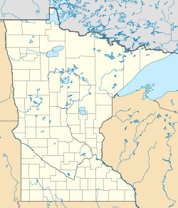
Kabetogama Township, St. Louis County, Minnesota
| Kabetogama Township, Minnesota | |
|---|---|
| Township | |
| Location within the state of Minnesota | |
| Coordinates: Lua error in package.lua at line 80: module 'strict' not found. | |
| Country | United States |
| State | Minnesota |
| County | Saint Louis |
| Area | |
| • Total | 33.2 sq mi (86.0 km2) |
| • Land | 16.1 sq mi (41.6 km2) |
| • Water | 17.1 sq mi (44.4 km2) |
| Elevation | 1,112 ft (339 m) |
| Population (2010) | |
| • Total | 135 |
| • Density | 4.1/sq mi (1.6/km2) |
| Time zone | Central (CST) (UTC-6) |
| • Summer (DST) | CDT (UTC-5) |
| GNIS feature ID | 2397817[1] |
| Website | www.kabetogamatownship.org |
Kabetogama Township is a township in Saint Louis County, Minnesota, United States. The population was 135 at the 2010 census.[2] A portion of the township is located within the Kabetogama State Forest.
Saint Louis County Roads 122 and 123 are two of the main routes in the township. U.S. Highway 53 is nearby. Voyageurs National Park is in the vicinity. Kabetogama Township is located along part of Kabetogama Lake.
The unincorporated community of Kabetogama is located within Kabetogama Township.
Geography
According to the United States Census Bureau, the unorganized territory has a total area of 33.2 square miles (86 km2); 16.1 square miles (42 km2) is land and 17.1 square miles (44 km2), or 51.60%, is water.
Kabetogama Township is the farthest north organized township in Saint Louis County.
The unincorporated community of Kabetogama, within Kabetogama Township, is located 27 miles southeast of International Falls; and 49 miles north of Cook.
Notes
Kabetogama Township is located along part of Kabetogama Lake. The lake is one of four major lakes that make up the Voyageurs National Park. The unincorporated community of Kabetogama is the gateway into the park.
Kabetogama Lake has 25,000 acres (100 km2) of waters and has 200 islands. Kabetogama is noted for walleye fishing. There are also northern pike, crappie, perch, and bass.
Kabetogama is a Chippewa name that means 'rough waters'. The lake lives up to its name when it is windy.
The Kabetogama area is also known for hunting of whitetail deer, black bear, and small game birds.
Demographics
As of the census[3] of 2000, there were 156 people, 72 households, and 50 families residing in the unorganized territory. The population density was 9.7 people per square mile (3.8/km²). There were 221 housing units at an average density of 13.8/sq mi (5.3/km²). The racial makeup of the unorganized territory was 99.36% White and 0.64% Native American.
There were 72 households out of which 19.4% had children under the age of 18 living with them, 66.7% were married couples living together, and 29.2% were non-families. 23.6% of all households were made up of individuals and 8.3% had someone living alone who was 65 years of age or older. The average household size was 2.17 and the average family size was 2.55.
In the unorganized territory the population was spread out with 17.3% under the age of 18, 3.2% from 18 to 24, 16.7% from 25 to 44, 40.4% from 45 to 64, and 22.4% who were 65 years of age or older. The median age was 52 years. For every 100 females there were 95.0 males. For every 100 females age 18 and over, there were 101.6 males.
The median income for a household in the unorganized territory was $42,000, and the median income for a family was $50,938. Males had a median income of $32,083 versus $6,250 for females. The per capita income for the unorganized territory was $32,176. None of the population or families were below the poverty line.

