Pea Island National Wildlife Refuge
Lua error in package.lua at line 80: module 'strict' not found.
| Pea Island National Wildlife Refuge | |
|---|---|
|
IUCN category IV (habitat/species management area)
|
|
| 284px
Dunes on NC 12 in June 2007
|
|
|
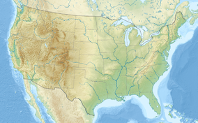
Map of the United States
|
|
| Location | Dare County, North Carolina, United States |
| Nearest city | Nags Head, North Carolina |
| Coordinates | Lua error in package.lua at line 80: module 'strict' not found. |
| Area | 31,534 acres (127.61 km2) |
| Established | 1938 |
| Governing body | U.S. Fish and Wildlife Service |
| http://www.fws.gov/peaisland/ | |
Pea Island National Wildlife Refuge is a National Wildlife Refuge located on North Carolina's Pea Island, a coastal barrier island and part of a chain of islands known as the Outer Banks, adjacent to Cape Hatteras National Seashore. The sanctuary is located 10 miles (16 km) south of Nags Head, North Carolina on NC 12.
The refuge's objectives are to provide nesting, resting, and wintering habitat for migratory birds, including the greater snow geese and other migratory waterfowl, shorebirds, wading birds, raptors, and neotropical migrants, as well as habitat and protection for endangered and threatened species. Objectives also include providing opportunities for public enjoyment of wildlife and wildlands resources. Public use programs focus on interpretation, environmental education, wildlife observation, wildlife photography, and fishing.
Contents
Refuge facts
The refuge was established May 17, 1937. It includes 5,834 acres (23.6 km²) of land and 25,700 acres (104 km²) Proclamation Boundary Waters. The refuge is approximately 13 miles (21 km) long (north to south) and ranges from a 1/4 mile (0.40 km) to 1 mile (1.6 km) wide (from east to west).
The refuge is administered by the Alligator River National Wildlife Refuge as a part of a refuge complex; the manager of the Alligator River refuge supervises the managers of the Mackay Island, Currituck, and Pocosin Lakes National Wildlife Refuges. The Comprehensive Conservation Management Plan for the refuge was completed in September 2006. A 36-person staff administers both Pea Island and Alligator River National Wildlife Refuges, with a budget of $2,827K (FY 03) for both refuges. Numerous volunteers devote approximately 35,000 hours each year to the Refuge.
There are 2.7 million visitors annually. Pea Island National Wildlife Refuge is known as a "Birder's Paradise"; birders make up some of the many visitors. Other eco-tourists include canoeists and kayakers, beachcombers, surf and sound anglers, and nature photographers.
Natural history
The refuge contains ocean beach, dunes, upland, fresh and brackish water ponds, salt flats, and salt marsh. There are more than 365 species of birds, 25 species of mammals, 24 species of reptiles, and five species of amphibians. There are concentrations of ducks, geese, swans, wading birds, shore birds, and raptors. There are neotropical migrants that are seasonally abundant on refuge. The refuge has 1,000 acres (4 km²) of manageable waterfowl impoundments, and there are several shorebird nesting areas and wading bird rookeries are located in the refuge. Endangered and threatened species include shortnose sturgeon, american alligator, red wolf, peregrine falcons, loggerhead sea turtles, green sea turtle, leatherback sea turtle, hawksbill sea turtle, Kemp's Ridley sea turtle, red-cockaded woodpecker, roseate tern, West Indian manatee, seabeach amaranth, and piping plovers.
The refuge area was historically used for market waterfowl hunting, commercial fishing, farming, and livestock operations.
See also
References
![]() This article incorporates public domain material from websites or documents of the United States Fish and Wildlife Service.
This article incorporates public domain material from websites or documents of the United States Fish and Wildlife Service.
Further reading
- Pea Island fact sheet (.pdf)
- Pea Island National Wildlife Refuge Comprehensive Conservation Plan. September 2006.
