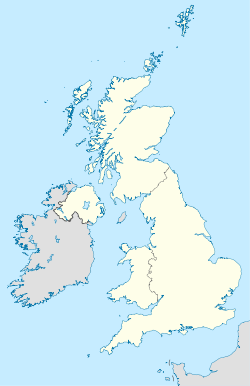
Currently the area has 49 non-sequentially numbered postal districts, three of which are 'non-geographical' being for bulk users in Sheffield and Rotherham.
Similarly, there were also S-prefixed postal districts in the compass-based system used in Glasgow: the former S1, S2, S3 and S4 areas on the South Side of Glasgow now have postcodes from G41 to G44.
The S20 district was formerly numbered S19; S21, S25 and S26 were formerly numbered S31, while S32 to S36 were formerly numbered S30.
The S64 district, Mexborough, was earmarked for use as DN13 which has never been used, see DN postcode area.
| Postcode district |
Post town |
Coverage |
Local authority area |
| S1 |
SHEFFIELD |
Sheffield City Centre |
Sheffield |
| S2 |
SHEFFIELD |
Arbourthorne, Heeley, Highfield, Manor, Norfolk Park, Wybourn, Park Hill |
Sheffield |
| S3 |
SHEFFIELD |
Broomhall, Burngreave, Neepsend, Netherthorpe |
Sheffield |
| S4 |
SHEFFIELD |
Grimesthorpe, Pitsmoor |
Sheffield |
| S5 |
SHEFFIELD |
Firth Park, Fir Vale, Longley, Shirecliffe, Shiregreen, Southey Green, Parson Cross |
Sheffield |
| S6 |
SHEFFIELD |
Bradfield, Dungworth, Hillsborough, Holdworth, Hollow Meadows, Loxley, Malin Bridge, Middlewood, Stannington, Storrs, Upperthorpe, Walkley, Wadsley Bridge, Wisewood, Wadsley |
Sheffield |
| S7 |
SHEFFIELD |
Abbeydale, Carter Knowle, Nether Edge, Millhouses |
Sheffield |
| S8 |
SHEFFIELD |
Batemoor, Beauchief, Greenhill, Jordanthorpe, Lowedges, Meersbrook, Norton, Norton Lees, Woodseats |
Sheffield |
| S9 |
SHEFFIELD |
Attercliffe, Brightside, Darnall, Meadowhall, Tinsley, Wincobank |
Sheffield |
| S10 |
SHEFFIELD |
Broomhill, Broomhall, Crookes, Crookesmoor, Crosspool, Fulwood, Ranmoor |
Sheffield |
| S11 |
SHEFFIELD |
Ecclesall, Endcliffe Park, Ecclesall Road, Greystones, Hunter's Bar, Millhouses, Sharrow Vale, Nether Edge, Whirlow |
Sheffield |
| S12 |
SHEFFIELD |
Birley, Gleadless, Gleadless Townend, Frecheville, Hackenthorpe, Intake, Ridgeway |
North East Derbyshire, Sheffield |
| S13 |
SHEFFIELD |
Handsworth, Richmond, Woodhouse |
Sheffield |
| S14 |
SHEFFIELD |
Gleadless Valley |
Sheffield |
| S17 |
SHEFFIELD |
Dore, Totley, Bradway |
Sheffield |
| S18 |
DRONFIELD |
Coal Aston, Dronfield, Dronfield Woodhouse, Holmesfield, Unstone |
North East Derbyshire |
| S19 |
Renumbered to S20 |
| S20 |
SHEFFIELD |
Beighton, Crystal Peaks, Halfway, Mosborough, Owlthorpe, Sothall, Waterthorpe, Westfield, |
Sheffield |
| S21 |
SHEFFIELD |
Eckington, Killamarsh, Renishaw, Spinkhill |
North East Derbyshire |
| S25 |
SHEFFIELD |
Anston, Dinnington, Laughton-en-le-Morthen |
Rotherham |
| S26 |
SHEFFIELD |
Aston, Aughton, Harthill, Kiveton Park, Swallownest, Todwick, Wales |
Rotherham |
| S30 |
Renumbered to S32, S33, S35, S36 |
| S31 |
Renumbered to S21, S25, S26 |
| S32 |
HOPE VALLEY |
Calver, Eyam, Grindleford, Hathersage, Stoney Middleton |
Derbyshire Dales |
| S33 |
HOPE VALLEY |
Bamford, Bradwell, Castleton, Edale, Hope, Yorkshire Bridge |
High Peak |
| S35 |
SHEFFIELD |
Chapeltown, Ecclesfield, Grenoside, High Green, Oughtibridge, Thurgoland, Wharncliffe Side, Wortley |
Sheffield |
| S36 |
SHEFFIELD |
Penistone, Thurlstone, Millhouse Green, Oxspring, Stocksbridge, Deepcar Bolsterstone |
Barnsley, Sheffield |
| S40 |
CHESTERFIELD |
Central and West Chesterfield, Brampton |
Chesterfield |
| S41 |
CHESTERFIELD |
Hasland, North Chesterfield, Old Whittington |
Chesterfield, North East Derbyshire |
| S42 |
CHESTERFIELD |
Holymoorside, Grassmoor, North Wingfield, Tupton, Wingerworth, Mastin Moor, |
Chesterfield, North East Derbyshire |
| S43 |
CHESTERFIELD |
Barlborough, Clowne, Inkersall Green, Staveley |
Bolsover, Chesterfield |
| S44 |
CHESTERFIELD |
Bolsover, Calow, Sutton-cum-Duckmanton, Scarcliffe |
Bolsover, North East Derbyshire |
| S45 |
CHESTERFIELD |
Ashover, Clay Cross, Pilsley |
North East Derbyshire |
| S49 |
CHESTERFIELD |
Bulk users |
|
| S60 |
ROTHERHAM |
Brinsworth, Catcliffe, Canklow, Clifton Central Rotherham, Masbrough, Moorgate, Treeton, Whiston |
Rotherham |
| S61 |
ROTHERHAM |
Greasbrough, Kimberworth, Rockingham, Thorpe Hesley, Munsborough, Scholes, Ferham |
Rotherham |
| S62 |
ROTHERHAM |
Rawmarsh, Wentworth, Parkgate |
Rotherham |
| S63 |
ROTHERHAM |
Bolton-on-Dearne, Goldthorpe, Thurnscoe, Wath-on-Dearne, West Melton |
Barnsley, Rotherham |
| S64 |
MEXBOROUGH |
Mexborough, Swinton, Kilnhurst, Adwick Upon Dearne |
Doncaster, Rotherham |
| S65 |
ROTHERHAM |
Herringthorpe, Hooton Roberts, Ravenfield, Thrybergh, East Dene |
|
| S66 |
ROTHERHAM |
Bramley Hellaby, Maltby, Thurcroft, Wickersley, Braithwell |
Rotherham |
| S70 |
BARNSLEY |
Central Barnsley, Birdwell, Stairfoot, Worsborough, Kendray |
Barnsley |
| S71 |
BARNSLEY |
Ardsley, Athersley, Monk Bretton, Lundwood, Royston |
Barnsley |
| S72 |
BARNSLEY |
Brierley, Cudworth, Grimethorpe, Shafton, South Hiendley |
Barnsley, City of Wakefield |
| S73 |
BARNSLEY |
Brampton, Darfield, Wombwell, Hemingfield |
Barnsley, Rotherham |
| S74 |
BARNSLEY SHEFFIELD |
Elsecar, Hoyland, Jump, Blacker Hill |
Barnsley Sheffield |
| S75 |
BARNSLEY |
Barugh Green, Cawthorne, Darton, Dodworth, Gawber, Mapplewell, Pogmoor, Staincross, Wilthorpe, Tankersley, Kexborough |
Barnsley |
| S80 |
WORKSOP |
Creswell, Thorpe Salvin, South Worksop, Whitwell |
Bassetlaw, Bolsover, Rotherham |
| S81 |
WORKSOP |
Blyth, Carlton-in-Lindrick, Langold, North Worksop, Shireoaks, Woodsetts |
Bassetlaw, Rotherham |
| S96 |
SHEFFIELD |
Bulk users |
|
| S97 |
ROTHERHAM, SHEFFIELD |
Bulk users |
|
| S98 |
SHEFFIELD |
Bulk users |
|

