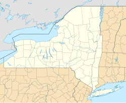
奧本 (紐約州)
外觀
| 奧本 Auburn | |
|---|---|
| 城市 | |
 Memorial City Hall (2012) | |
| 綽號:History's Hometown | |
| 坐標:42°55′54″N 76°33′53″W / 42.931661°N 76.564769°W | |
| 國家 | 美國 |
| 州 | 紐約州 |
| 郡 | 卡尤加郡 |
| Incorporated | 1815年(村) 1848年(市) |
| 政府 | |
| • 類型 | 議會-經理制政府 |
| • 市長 | Michael D Quill Sr(D) |
| • City Council | Members' List |
| 面積 | |
| • 總計 | 8.4 平方英里(21.8 平方公里) |
| • 陸地 | 8.4 平方英里(21.7 平方公里) |
| • 水域 | 0.0 平方英里(0.1 平方公里) |
| 海拔 | 686 英尺(209 公尺) |
| 人口(2010年普查) | |
| • 總計 | 27,687人 |
| • 密度 | 3,296人/平方英里(1,270人/平方公里) |
| 時區 | 北美東部時區(EST)(UTC-5) |
| • 夏時制 | EDT(UTC-4) |
| ZIP codes | 13021, 13022, 13024 |
| 電話區號 | 315 |
| FIPS code | 36-03078 |
| GNIS feature ID | 0942692 |
| 網站 | ci |
奧本(Auburn)是美國紐約州的一個城市,是卡尤加郡郡治。面積21.8平方公里。根據美國2000年人口普查,共有人口28,574人。
歷史
[編輯]
在歐洲人踏入美洲大陸之前,奧本在幾世紀以來一直都是美洲原住民易洛魁聯盟的領土。
地理和氣候
[編輯]氣候
| 紐約州奧本市 | |||||||||||||
|---|---|---|---|---|---|---|---|---|---|---|---|---|---|
| 月份 | 1月 | 2月 | 3月 | 4月 | 5月 | 6月 | 7月 | 8月 | 9月 | 10月 | 11月 | 12月 | 全年 |
| 歷史最高溫 °F(°C) | 65 (18) |
66 (19) |
85 (29) |
92 (33) |
94 (34) |
101 (38) |
100 (38) |
99 (37) |
99 (37) |
92 (33) |
78 (26) |
64 (18) |
101 (38) |
| 平均高溫 °F(°C) | 30.0 (−1.1) |
32.1 (0.1) |
41.9 (5.5) |
54.1 (12.3) |
67.2 (19.6) |
76.1 (24.5) |
80.8 (27.1) |
78.4 (25.8) |
70.7 (21.5) |
58.9 (14.9) |
46.7 (8.2) |
35.6 (2.0) |
56.0 (13.4) |
| 平均低溫 °F(°C) | 12.0 (−11.1) |
12.1 (−11.1) |
21.9 (−5.6) |
33.1 (0.6) |
44.8 (7.1) |
54.6 (12.6) |
60.1 (15.6) |
58.7 (14.8) |
50.2 (10.1) |
39.1 (3.9) |
29.9 (−1.2) |
19.5 (−6.9) |
36.3 (2.4) |
| 歷史最低溫 °F(°C) | −23 (−31) |
−32 (−36) |
−14 (−26) |
12 (−11) |
26 (−3) |
33 (1) |
39 (4) |
39 (4) |
28 (−2) |
16 (−9) |
1 (−17) |
−21 (−29) |
−32 (−36) |
| 平均降水量 吋(mm) | 2.70 (69) |
2.28 (58) |
3.03 (77) |
3.24 (82) |
3.61 (92) |
4.37 (111) |
4.17 (106) |
3.69 (94) |
4.28 (109) |
3.82 (97) |
3.74 (95) |
3.42 (87) |
42.35 (1,077) |
| 平均降雪量 吋(cm) | 34.8 (88) |
19.0 (48) |
15.3 (39) |
3.0 (7.6) |
.9 (2.3) |
0 (0) |
0 (0) |
0 (0) |
trace | .8 (2.0) |
7.9 (20) |
19.9 (51) |
101.6 (258) |
| 平均降水天數(≥ 0.01 in) | 18.5 | 15.9 | 13.6 | 12.1 | 13.6 | 13.9 | 11.2 | 11.0 | 13.2 | 13.6 | 13.5 | 18.2 | 168.3 |
| 平均降雪天數(≥ 0.1 in) | 11.5 | 8.2 | 5.5 | 1.3 | .1 | 0 | 0 | 0 | 0 | .4 | 3.4 | 8.5 | 38.9 |
| 數據來源:NOAA (1971−2000),[1] The Weather Channel (Precipitation and Extremes) [2] | |||||||||||||
人口
[編輯]| 年份 | 人口 | ±% |
|---|---|---|
| 1800 | — | |
| 1810 | — | |
| 1820 | — | |
| 1830 | — | |
| 1840 | 5,626 | — |
| 1850 | 9,548 | +69.7% |
| 1860 | 10,986 | +15.1% |
| 1870 | 17,225 | +56.8% |
| 1880 | 21,924 | +27.3% |
| 1890 | 25,858 | +17.9% |
| 1900 | 30,345 | +17.4% |
| 1910 | 34,668 | +14.2% |
| 1920 | 36,192 | +4.4% |
| 1930 | 36,652 | +1.3% |
| 1940 | 35,753 | −2.5% |
| 1950 | 36,722 | +2.7% |
| 1960 | 35,249 | −4.0% |
| 1970 | 34,319 | −2.6% |
| 1980 | 32,548 | −5.2% |
| 1990 | 31,258 | −4.0% |
| 2000 | 28,574 | −8.6% |
| 2010 | 27,687 | −3.1% |
| sources:[3] | ||
知名人物
[編輯]威廉·H·西華德之家(攝於2012年)
哈莉特·塔布曼國家歷史公園(攝於2007年)
- 威廉·亨利·西華德(1801年-1872年):政治人物,曾任紐約州參議員、紐約州州長和美國國務卿。
- 瑪莎·科芬·賴特(1806年-1875年):女性主義者,感傷宣言的簽署者之一。
- 阿布納·道布爾迪(1819年-1893年):南北戰爭時期北方軍陸軍少將。
- 波德希爾·霍利(1820年-1894年):發明了消防栓的發明家。
- 哈莉特·塔布曼(1822年-1913年):前黑奴,廢奴主義者,透過地下鐵路幫助眾多黑奴逃跑。
- 安妮·埃德森·泰勒(1838年-1921年):第一位乘坐木桶穿越尼加拉大瀑布並得以倖存的人物。
- 威廉·凱姆勒(1860年-1890年):第一個被以電椅處決的人,在奧本監獄被處刑。
- 西奧多·凱斯(1888年-1944年):發明家,開發了第一個在商業上獲得成功的音軌錄音技術系統。
參考文獻
[編輯]- ^ Climatology of the United States No. 20: AUBURN, NY 1971-2000 (PDF). National Oceanic and Atmospheric Administration. [2011年11月]. (原始內容 (PDF)存檔於2014年7月18日).
- ^ Monthly Averages for Auburn, NY (13021). The Weather Channel. [2011年11月]. (原始內容存檔於2014-07-02).
- ^ Campbell Gibson. Population of the 100 largest cities and other urban places in the United States: 1790 to 1990. United States Bureau of the Census. [2012-08-07]. (原始內容存檔於2011-04-30).
外部連結
[編輯]- 奧本市官方網站 美國國會圖書館的存檔,存檔日期2015-05-17
- 卡尤加經濟發展署 (頁面存檔備份,存於互聯網檔案館)
- Cayuga County Chamber of Commerce (頁面存檔備份,存於互聯網檔案館)
- Seymour Library (頁面存檔備份,存於互聯網檔案館)
- Willard Memorial Chapel
- Cayuga Museum of History & Art and The Case Research Lab Museum (頁面存檔備份,存於互聯網檔案館)
- Auburn Players Community Theatre, Inc.
- Finger Lakes Musical Theatre Festival Archive.is的存檔,存檔日期2013-06-20
- Auburn Public Theater (頁面存檔備份,存於互聯網檔案館)
- Cayuga County Arts Council Network
- Auburn Musical Theatre Festival
- Schweinfurth Memorial Art Center (頁面存檔備份,存於互聯網檔案館)
- Ward W. O'Hara Agricultural Museum (頁面存檔備份,存於互聯網檔案館)
- Auburn History, Old Newspaper Articles, Genealogy (頁面存檔備份,存於互聯網檔案館)
- Cayuga Community College


