Čeladná
Čeladná | |
|---|---|
 Centre of Čeladná | |
| Coordinates: 49°32′51″N 18°20′14″E / 49.54750°N 18.33722°E | |
| Country | |
| Region | Moravian-Silesian |
| District | Frýdek-Místek |
| First mentioned | 1581 |
| Area | |
• Total | 59.06 km2 (22.80 sq mi) |
| Elevation | 430 m (1,410 ft) |
| Population (2024-01-01)[1] | |
• Total | 2,904 |
| • Density | 49/km2 (130/sq mi) |
| Time zone | UTC+1 (CET) |
| • Summer (DST) | UTC+2 (CEST) |
| Postal code | 739 12 |
| Website | www |
Čeladná is a municipality and village in the Frýdek-Místek District in the Moravian-Silesian Region of the Czech Republic. It has about 2,900 inhabitants.
Geography
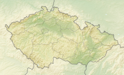
[edit]Čeladná is located about 14 kilometres (9 mi) south of Frýdek-Místek and 27 km (17 mi) south of Ostrava. It lies in the Moravian-Silesian Beskids mountain range. The highest point is the Smrk mountain at 1,276 m (4,186 ft) above sea level. The municipality is situated in the valley of the Čeladenka stream.
History
[edit]The first written mention of Čeladná is from 1581.[2]
The spa and rehabilitation centre were founded here in 1902. From the 1950s to 2000, the activity of the spa was suspended and there was a hospital and a famous maternity hospital on the premises, therefore Čeladná is the birthplace of many personalities.[3]
Demographics
[edit]
|
|
| ||||||||||||||||||||||||||||||||||||||||||||||||||||||
| Source: Censuses[4][5] | ||||||||||||||||||||||||||||||||||||||||||||||||||||||||
Economy
[edit]Čeladná is known for its spa and rehabilitation centre. It is the main employer in the municipality.[3]
In the 21st century, Čeladná has become a popular holiday resort with new hotels and infrastructure.[6]
Transport
[edit]Čeladná is located on the railway line Valašské Meziříčí–Frýdlant nad Ostravicí.[7]
Sport
[edit]Čeladná is renowned for the largest golf course in the Czech Republic.[6]
Sights
[edit]The Chapel of Saints Cyril and Methodius was built in 1936 and is inspired by the work of Dušan Jurkovič.[8]
Notable people
[edit]- Miroslava Jaškovská (born 1955), cross-country skier
- Ivo Valenta (born 1956), businessman and politician
- Iveta Bartošová (1966–2014), singer
- Ondřej Kratěna (born 1977), ice hockey player
- Pavel Kubina (born 1977), ice hockey player
- Jakub Janda (born 1978), ski jumper and politician
- Adam Lacko (born 1984), racing driver
- Jan Mazoch (born 1985), ski jumper
References
[edit]- ^ "Population of Municipalities – 1 January 2024". Czech Statistical Office. 2024-05-17.
- ^ "Historie" (in Czech). Obec Čeladná. Retrieved 2023-12-11.
- ^ a b "Beskydské rehabilitační centrum" (in Czech). Obec Čeladná. Retrieved 2022-02-14.
- ^ "Historický lexikon obcí České republiky 1869–2011" (in Czech). Czech Statistical Office. 2015-12-21.
- ^ "Population Census 2021: Population by sex". Public Database. Czech Statistical Office. 2021-03-27.
- ^ a b "Současnost" (in Czech). Obec Čeladná. Retrieved 2022-02-14.
- ^ "Detail stanice Čeladná" (in Czech). České dráhy. Retrieved 2023-12-11.
- ^ "Kaple sv. Cyrila a Metoděje" (in Czech). National Heritage Institute. Retrieved 2023-12-11.


