Roanoke, Virginia
Roanoke, Virginia | ||
|---|---|---|
 Tanawin ng Roanoke. | ||
| ||
| Palayaw: The Star City of The South or Magic City | ||
| Mga koordinado: 37°16′15″N 79°56′30″W / 37.27083°N 79.94167°W | ||
| Bansa | Estados Unidos | |
| Estado | Virginia | |
| Kondado | Wala (Nagsasariling lungsod) | |
| Pamahalaan | ||
| • Uri | Council-Manager | |
| • Alkalde | Sherman Lea | |
| Lawak | ||
| • Nagsasariling lungsod | 110 km2 (43 milya kuwadrado) | |
| • Lupa | 110 km2 (43 milya kuwadrado) | |
| • Tubig | 0.8 km2 (0.3 milya kuwadrado) | |
| Taas | 269–530 m (883–1,740 tal) | |
| Populasyon (2010) | ||
| • Nagsasariling lungsod | 97,032 | |
| • Kapal | 870/km2 (2,300/milya kuwadrado) | |
| • Metro | 312,331 | |
| Sona ng oras | UTC-5 (Eastern (EST)) | |
| • Tag-init (DST) | UTC-4 (EDT) | |
| Mga kodigong postal | 24001–24020, 24022–24038, 24040, 24042–24045, 24048, 24050, 24155, 24157 | |
| Kodigo ng lugar | 540 | |
| Kodigong FIPS | 51-68000[3] | |
| GNIS feature ID | 1499971[4] | |
| Websayt | www.roanokeva.gov | |
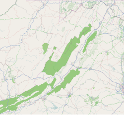
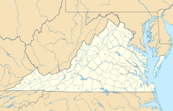
Ang Roanoke ay isang nagsasariling lungsod sa estado ng Virginia. Magmula noong senso 2010, ang populasyon ay 97,032 katao.[5] Matatagpuan ito sa Lambak ng Roanoke sa Rehiyong Roanoke ng Virginia.[6] Hinahati ito ng Ilog Roanoke sa dalawang bahagi.
Pinakamalaking munisipalidad ang Roanoke sa Timog-kanlurang Virginia, at ang pangunahing munisipalidad ng Kalakhang pook ng Roanoke, na may populasyon noong 2010 na 308,707 katao at binubuo ng mga nagsasariling lungsod ng Roanoke at Salem, at mga kondado ng Botetourt, Craig, Franklin, at Roanoke. Ang Roanoke ay ang pusod ng komersiyo at kultura sa karamihan ng Timog-kanlurang Virginia at mga bahagi ng Katimugang Kanlurang Virginia.[7][8]
Demograpiya
[baguhin | baguhin ang wikitext]| Taon | Pop. | ±% |
|---|---|---|
| 1880 | 669 | — |
| 1890 | 16,159 | +2315.4% |
| 1900 | 21,495 | +33.0% |
| 1910 | 34,874 | +62.2% |
| 1920 | 50,842 | +45.8% |
| 1930 | 69,206 | +36.1% |
| 1940 | 69,287 | +0.1% |
| 1950 | 91,921 | +32.7% |
| 1960 | 97,110 | +5.6% |
| 1970 | 92,115 | −5.1% |
| 1980 | 100,220 | +8.8% |
| 1990 | 96,397 | −3.8% |
| 2000 | 94,911 | −1.5% |
| 2010 | 97,032 | +2.2% |
| 2016 | 99,660 | +2.7% |
| Pagtataya 2016:[9]; U.S. Decennial Census:[10] 1790-1960[11] 1900-1990[12] 1990-2000[13] 2010-2012[5] | ||
Mga kapatid na lungsod
[baguhin | baguhin ang wikitext]May pitong mga kapatid na lungsod ang Roanoke nang itinakda ng Sister Cities International:
Mga sanggunian
[baguhin | baguhin ang wikitext]- ↑ "Virginia Birding and Wildlife Trail » Mountain Trail » Star City » Roanoke Water Pollution Control Plant". Dgif.state.va.us. Nakuha noong 27 Agosto 2009.
{{cite web}}: CS1 maint: date auto-translated (link)[patay na link] - ↑ "Roanoke City High Point Trip Report". Cohp.org. 17 Nobyembre 2000. Nakuha noong 27 Agosto 2009.
{{cite web}}: CS1 maint: date auto-translated (link) - ↑ "American FactFinder". United States Census Bureau. Inarkibo mula sa orihinal noong 11 Setyembre 2013. Nakuha noong 31 Enero 2008.
{{cite web}}: Unknown parameter|deadurl=ignored (|url-status=suggested) (tulong)CS1 maint: date auto-translated (link) - ↑ "US Board on Geographic Names". United States Geological Survey. 25 Oktubre 2007. Nakuha noong 2008-01-31.
{{cite web}}: CS1 maint: date auto-translated (link) - ↑ 5.0 5.1 "State & County QuickFacts". United States Census Bureau. Inarkibo mula sa orihinal noong 2014-01-07. Nakuha noong 6 Enero 2014.
{{cite web}}: CS1 maint: date auto-translated (link) - ↑ "Roanoke Region of Virginia". Roanoke.org. Nakuha noong 27 Agosto 2009.
{{cite web}}: CS1 maint: date auto-translated (link) - ↑ "Roanoke Regional Trade Area". Roanoke.org. Inarkibo mula sa orihinal noong 2014-04-13. Nakuha noong 11 Abril 2014.
{{cite web}}: CS1 maint: date auto-translated (link) - ↑ "Roanoke-Lynchburg DMA Map". newportmedia.com. Nakuha noong 11 Abril 2014.
{{cite web}}: CS1 maint: date auto-translated (link)[patay na link] - ↑ "Population and Housing Unit Estimates". Nakuha noong 9 Hunyo 2017.
{{cite web}}: CS1 maint: date auto-translated (link) - ↑ "U.S. Decennial Census". United States Census Bureau. Inarkibo mula sa orihinal noong 2015-05-12. Nakuha noong 6 Enero 2014.
{{cite web}}: Unknown parameter|deadurl=ignored (|url-status=suggested) (tulong)CS1 maint: date auto-translated (link) - ↑ "Historical Census Browser". University of Virginia Library. Inarkibo mula sa orihinal noong Agosto 11, 2012. Nakuha noong Enero 6, 2014.
{{cite web}}: CS1 maint: date auto-translated (link) - ↑ "Population of Counties by Decennial Census: 1900 to 1990". United States Census Bureau. Nakuha noong 6 Enero 2014.
{{cite web}}: CS1 maint: date auto-translated (link) - ↑ "Census 2000 PHC-T-4. Ranking Tables for Counties: 1990 and 2000" (PDF). United States Census Bureau. Nakuha noong 6 Enero 2014.
{{cite web}}: CS1 maint: date auto-translated (link) - ↑ "Miasta Partnerskie Opola". Urzad Miasta Opola (sa wikang Polako). Inarkibo mula sa orihinal noong Agosto 1, 2013. Nakuha noong Agosto 1, 2013.
{{cite web}}: Unknown parameter|deadurl=ignored (|url-status=suggested) (tulong)CS1 maint: date auto-translated (link)
Mga kawing panlabas
[baguhin | baguhin ang wikitext]- AIR Temporary Exhibition
- The History of the Roanoke Fire Department in progress from the 1880s to present, with current news and links Naka-arkibo 2021-02-26 sa Wayback Machine.
- Old Roanoke – A photographic history of Roanoke Virginia Naka-arkibo 2018-11-30 sa Wayback Machine.
- Center in the Square
- Brief history and modern panoramic photos from the Roanoke Civil War Round Table Naka-arkibo 2021-02-26 sa Wayback Machine.
- Taubman Museum of Art
- "City of Roanoke". County and City Records. Richmond: Library of Virginia.
- Items related to Roanoke, Virginia, various dates (via Digital Public Library of America)
- Roanoke Public Libraries. "Virginia Room". City of Roanoke. Inarkibo mula sa orihinal noong 2017-08-25. Nakuha noong 2017-09-23.
{{cite web}}: CS1 maint: date auto-translated (link) (Local history collection)


