Papers by Ana Djuricic (Puttonen)

The world's largest fossil oyster reef, formed by the giant oyster Crassostrea gryphoides and... more The world's largest fossil oyster reef, formed by the giant oyster Crassostrea gryphoides and located in Stetten (north of Vienna, Austria) is studied by Harzhauser et al., 2015, 2016; Djuricic et al., 2016. Digital documentation of the unique geological site is provided by terrestrial laser scanning (TLS) at the millimeter scale. Obtaining meaningful results is not merely a matter of data acquisition with a suitable device; it requires proper planning, data management, and postprocessing. Terrestrial laser scanning technology has a high potential for providing precise 3D mapping that serves as the basis for automatic object detection in different scenarios; however, it faces challenges in the presence of large amounts of data and the irregular geometry of an oyster reef. We provide a detailed description of the techniques and strategy used for data collection and processing in Djuricic et al., 2016. The use of laser scanning provided the ability to measure surface points of 46,840 (estimated) shells. They are up to 60-cm-long oyster specimens, and their surfaces are modeled with a high accuracy of 1 mm. In addition to laser scanning measurements, more than 300 photographs were captured, and an orthophoto mosaic was generated with a ground sampling distance (GSD) of 0.5 mm. This high-resolution 3D information and the photographic texture serve as the basis for ongoing and future geological and paleontological analyses. Moreover, they provide unprecedented documentation for conservation issues at a unique natural heritage site.

International journal of earth sciences : Geologische Rundschau, 2018
Shell beds represent a useful source of information on various physical processes that cause the ... more Shell beds represent a useful source of information on various physical processes that cause the depositional condition. We present an automated method to calculate the 3D orientations of a large number of elongate and platy objects (fossilized oyster shells) on a sedimentary bedding plane, developed to support the interpretation of possible depositional patterns, imbrications, or impact of local faults. The study focusses on more than 1900 fossil oyster shells exposed in a densely packed Miocene shell bed. 3D data were acquired by terrestrial laser scanning on an area of 459 m with a resolution of 1 mm. Bivalve shells were manually defined as 3D-point clouds of a digital surface model and stored in an ArcGIS database. An individual shell coordinate system (ISCS) was virtually embedded into each shell and its orientation was determined relative to the coordinate system of the entire, tectonically tilted shell bed. Orientation is described by the rotation angles roll, pitch, and yaw ...
ISPRS Annals of Photogrammetry, Remote Sensing and Spatial Information Sciences, 2016
Photogrammetry provides a powerful tool to digitally document protected, inaccessible, and rare f... more Photogrammetry provides a powerful tool to digitally document protected, inaccessible, and rare fossils. This saves manpower in relation to current documentation practice and makes the fragile specimens more available for paleontological analysis and public education. In this study, high resolution orthophoto (0.5 mm) and digital surface models (1 mm) are used to define fossil boundaries that are then used as an input to automatically extract fossil length information via central lines. In general, central lines are widely used in geosciences as they ease observation, monitoring and evaluation of object dimensions. Here, the 3D central lines are used in a novel paleontological context to study fossilized oyster shells with photogrammetric and LiDAR-obtained 3D point cloud data. 3D central lines of 1121 <i>Crassostrea gryphoides</i> oysters of various shapes and sizes were computed in the study. Central line calculation included: i) Delaunay triangulation between the foss...

Geosphere, 2016
The world's largest fossil oyster reef, formed by the giant oyster Crassostrea gryphoides and loc... more The world's largest fossil oyster reef, formed by the giant oyster Crassostrea gryphoides and located in Stetten (north of Vienna, Austria), is studied in this article. Digital documentation of the unique geological site is provided by terrestrial laser scanning (TLS) at the millimeter scale. Obtaining meaningful results is not merely a matter of data acquisition with a suitable device; it requires proper planning, data management, and postprocessing. Terrestrial laser scanning technology has a high potential for providing precise 3D mapping that serves as the basis for automatic object detection in different scenarios; however, it faces challenges in the presence of large amounts of data and the irregular geometry of an oyster reef. We provide a detailed description of the techniques and strategy used for data collection and processing. The use of laser scanning provided the ability to measure surface points of 46,840 (estimated) shells. They are up to 60-cm-long oyster specimens, and their surfaces are modeled with a high accuracy of 1 mm. In addition, we propose an automatic analysis method for identifying and enumerating convex parts of shells. Object surfaces were detected with a completeness of 69% and a correctness of over 75% by means of a fully automated workflow. Accuracy of 98% was achieved in detecting the number of objects. In addition to laser scanning measurements, more than 300 photographs were captured, and an orthophoto mosaic was generated with a ground sampling distance (GSD) of 0.5 mm. This high-resolution 3D information and the photographic texture serve as the basis for ongoing and future geological and paleontological analyses. Moreover, they provide unprecedented documentation for conservation issues at a unique natural heritage site. This paper is published under the terms of the CC-BY license.

Biogeosciences Discussions, 2015
We present the first analysis of population structure and cohort distribution in a fossil oyster ... more We present the first analysis of population structure and cohort distribution in a fossil oyster reef based on more than 1121 shells of the giant oyster Crassostrea gryphoides (Schlotheim, 1813). Data derive from Terrestrial Laser Scanning of a Lower Miocene shell bed covering 459 m 2. Within two transects, individual shells were manually outlined on a digital surface model and cross-checked based on high-resolution orthophotos, resulting in accurate information on center line length and area of exposed shell surface. A growth model was calculated, revealing this species as the fastest growing and largest Crassostrea known so far. Non-normal distribution of size, area and age data hints at the presence of at least four distinct recruitment cohorts. The rapid decline of frequency amplitudes with age is interpreted to be a function of mortality and shell loss. The calculated shell half-lives range around few years, indicating that oyster reefs were geologically short-lived structures, which could have been fully degraded on a decadal scale. Crassostrea gryphoides reefs were widespread and common along the Miocene circum-Tethyan coasts. Given its enormous growth performance of ∼ 150 g carbonate per year this species has been an important carbonate producer in estuarine settings. Yet, the rapid shell loss impeded the formation of stable structures comparable to coral reefs.
Palaeogeography, Palaeoclimatology, Palaeoecology, 2015
We present the largest GIS-based data set of a single shell bed, comprising more than 10,280 manu... more We present the largest GIS-based data set of a single shell bed, comprising more than 10,280 manually outlined objects. The data are derived from a digital surface model based on high-resolution terrestrial laser scanning (TLS) and orthophotos obtained by photogrammetric survey, with a sampling distance of 1 mm and 0.5 mm, respectively. The shell bed is an event deposit, formed by a tsunami or an exceptional storm in an Early Miocene estuary. Disarticulated shells of the giant oyster Crassostrea gryphoides are the most frequent objects along with venerid, mytilid and solenid bivalves and potamidid gastropods. The contradicting ecological requirements and different grades of preservation of the various taxa mixed in the shell bed, along with a statistical analysis of the correlations of occurrences of the species, reveal an amalgamation of at least two pre-and two post-event phases of settlement under different environmental conditions. Certain areas of the shell bed display seemingly significant but opposing shell orientations. These patterns in coquinas formed by densely spaced elongate shells may result from local alignment of neighboring valves due to occasional events and bioturbation during the years of exposure. Similarly, the patchy occurrence of high ratios of shells in stable convex-up positions may simply be a result of such "maturity" effects. Finally, we document the difficulties in detecting potential tsunami signatures in shallow marine settings even in exceptionally preserved shell beds due to taphonomic bias by post-event processes.
http://meetingorganizer.copernicus.org/EGU2014/EGU2014-16040-5.pdf

The description and evaluation of geological, sedimentary and paleontological features in the fie... more The description and evaluation of geological, sedimentary and paleontological features in the field is often rather subjective. Many conclusions are based on view measurements on subjectively chosen elements, thought to be representative for the entire setting. One method to overcome this problem is the data acquisition by terrestrial laser scanning, which provides objective data sets. Here we present a key study conducted on the unique fossil oyster reef at Stetten in Lower Austria. The 400-m 2 -large site presents the world's largest fossil oyster biostrome with about 15.000 up to 80-cm-long shells. Despite the excellent preservation and accessibility, the analysis of this spectacular taphocenosis is still missing. No data on orientation, taphonomic grades, distribution and sorting are available. In a first step, a Terrestrial Laserscanner (TLS) was used for the determination of the geometrical 3D structures. The respective area is represented by a "raw" point cloud ...
The International Archives of the Photogrammetry, Remote Sensing and Spatial Information Sciences, 2013
Unmanned Aerial Vehicles (UAVs) are nowadays promising platforms for capturing spatial informatio... more Unmanned Aerial Vehicles (UAVs) are nowadays promising platforms for capturing spatial information, because they are low cost solutions, which are easy to bring to the surveying field and can operate automatically. Usually these devices are equipped with visual sensors to support the navigation of the platform or to transmit observations of the environment to the operator. By collecting the data and processing the captured images even an estimation of the observed environment in form of 3D information is available. Therefore Simultaneous Localization and Mapping (SLAM) algorithms are well known for processing data which is captured in the visible domain. However, situations can occur where gathering visual information is difficult due to given limitations in form of low visibility. For example if soft obstacles in form of translucent materials are given in disaster scenarios with smoke and operating has still to be ensured, active optical sensors (e.g. laser scanners) are gaining interest because they can penetrate the soft obstacle and allow to acquire information behind it. A new lightweight (210g), simplified and minimized scanning unit is now available which allows to capture multiple reflections for each transmitted laser pulse, namely the Hokuyo UTM-30LX-EW. With such a device, it is possible to overcome the above mentioned restrictions or limitations of low visibility by soft obstacles and even measure under critical circumstances. A multi-pulse system can provide accurate measurements on, within, and behind the soft obstacle. This research focuses on investigating the ability and performance of a laser scanner to penetrate the soft obstacle. Thus, investigations on a system that overcomes these limitations and provides a solution will be given. First promising experimental results considering soft obstacle are described.

Laser scanning technology provides a precise and objective methodology for documenting paleontolo... more Laser scanning technology provides a precise and objective methodology for documenting paleontological objects from in-situ localities (to support for instance museum digital documentation). It is a non-destructive approach for documenting in-situ fossils, capturing the geological context and expanding the availability of specimens that may be rare or fragile. This technique was recently applied for a 3D modelling of a protected fossil oyster reef exposed in the geopark "Fossilienwelt Weinviertel" in NE Austria (HARZHAUSER et al., 2015, 2016). The site represents the world's largest fossil oyster reef, but due to the fragility of the fossils it is difficult to study. Figure 1: Terrestrial laser scanning campaign on the world's largest fossil oyster reef in the exhibition hall at Stetten in Austria. The reef's digital surface model provides extensive digital data for developing new algorithm workflows for roughness quantification on individual oyster shell. This allows reliable computations of surface shell condition, i.e. surface roughness used in paleontological analyses of bioerosion, epibenthic overgrowth or abrasion (smoothness of shells). Roughness is derived automatically from geometry data based on the vertical component of surface normals, the sigma0 (standard deviation of plane fitting residuals of reef points) and the local slope (steepness indicator).

Shell beds represent a useful source of information on various physical processes that cause the ... more Shell beds represent a useful source of information on various physical processes that cause the depositional condition. We present an automated method to calculate the 3D orientations of a large number of elongate and platy objects (fossilized oyster shells) on a sedimentary bedding plane, developed to support the interpretation of possible depositional patterns, imbrications, or impact of local faults. The study focusses on more than 1900 fossil oyster shells exposed in a densely packed Miocene shell bed. 3D data were acquired by terrestrial laser scanning on an area of 459 m 2 with a resolution of 1 mm. Bivalve shells were manually defined as 3D-point clouds of a digital surface model and stored in an ArcGIS database. An individual shell coordinate system (ISCS) was virtually embedded into each shell and its orientation was determined relative to the coordinate system of the entire, tectonically tilted shell bed. Orientation is described by the rotation angles roll, pitch, and yaw in a Cartesian coordinate system. This method allows an efficient measurement and analysis of the orientation of thousands of specimens and is a major advantage compared to the traditional 2D approach, which measures only the azi-muth (yaw) angles. The resulting data can variously be utilized for taphonomic analyses and the reconstruction of prevailing hydrodynamic regimes and depositional environments. For the first time, the influence of possible post-sedimentary vertical displacements can be quantified with high accuracy. Here, the effect of nearby fault lines—present in the reef—was tested on strongly tilted oyster shells, but it was found out that the fault lines did not have a statistically significant effect on the large tilt angles. Aside from the high reproducibility, a further advantage of the method is its non-destructive nature, which is especially suitable for geoparks and protected sites such as the studied shell bed.

The world’s largest fossil oyster reef, formed by the giant oyster Crassostrea gryphoides and loc... more The world’s largest fossil oyster reef, formed by the giant oyster Crassostrea gryphoides and located in Stetten (north of Vienna, Austria), is studied in this article. Digital documentation of the unique geological site is provided by terrestrial laser scanning (TLS) at the millimeter scale. Obtaining meaningful results is not merely a matter of data acquisition with a suitable device; it requires proper planning, data management, and postprocessing. Terrestrial laser
scanning technology has a high potential for providing precise 3D mapping that serves as the basis for automatic object detection in different scenarios; however, it faces challenges in the presence of large amounts of data and the irregular geometry of an oyster reef. We provide a detailed description of the techniques and strategy used for data collection and processing. The use of laser scanning provided the ability to measure surface points of 46,840 (estimated) shells. They are up to 60-cm-long oyster specimens, and their surfaces are modeled with a high accuracy of 1 mm. In addition, we propose an automatic analysis method for identifying and enumerating convex parts of shells. Object surfaces were detected with a completeness of 69% and a correctness
of over 75% by means of a fully automated workflow. Accuracy of 98%
was achieved in detecting the number of objects. In addition to laser scanning measurements, more than 300 photographs were captured, and an orthophoto mosaic was generated with a ground sampling distance (GSD) of 0.5 mm. This high-resolution 3D information and the photographic texture serve as the basis for ongoing and future geological and paleontological analyses. Moreover, they provide unprecedented documentation for conservation issues at a unique
natural heritage site.

Photogrammetry provides a powerful tool to digitally document protected, inaccessible, and rare f... more Photogrammetry provides a powerful tool to digitally document protected, inaccessible, and rare fossils. This saves manpower in relation to current documentation practice and makes the fragile specimens more available for paleontological analysis and public education. In this study, high resolution orthophoto (0.5 mm) and digital surface models (1 mm) are used to define fossil boundaries that are then used as an input to automatically extract fossil length information via central lines. In general, central lines are widely used in geosciences as they ease observation, monitoring and evaluation of object dimensions. Here, the 3D central lines are used in a novel paleontological context to study fossilized oyster shells with photogrammetric and LiDAR-obtained 3D point cloud data. 3D central lines of 1121 Crassostrea gryphoides oysters of various shapes and sizes were computed in the study. Central line calculation included: i) Delaunay triangulation between the fossil shell boundary points and formation of the Voronoi diagram; ii) extraction of Voronoi vertices and construction of a connected graph tree from them; iii) reduction of the graph to the longest possible central line via Dijkstra's algorithm; iv) extension of longest central line to the shell boundary and smoothing by an adjustment of cubic spline curve; and v) integration of the central line into the corresponding 3D point cloud. The resulting longest path estimate for the 3D central line is a size parameter that can be applied in oyster shell age determination both in paleontological and biological applications. Our investigation evaluates ability and performance of the central line method to measure shell sizes accurately by comparing automatically extracted central lines with manually collected reference data used in paleontological analysis. Our results show that the automatically obtained central line length overestimated the manually collected reference by 1.5% in the test set, which is deemed sufficient for the selected paleontological application, namely shell age determination.

An excavated Miocene oyster reef (27x17 meters!) in Stetten, Lower Austria (part of the Korneubur... more An excavated Miocene oyster reef (27x17 meters!) in Stetten, Lower Austria (part of the Korneuburg B asin) w as l aser scanned in h igh r esolution. The r eef c onsist m ostly o f Crassostrea g ryphoides s hells, f orming a 1 5-20 c m t hick l ayer. The tectonic processes since the burial of the layer tilted it and formed faults clearly visible on the s urface o f t he l ayer. Typically long, NNW-SSE, almost parallel faults separated each of ther by ~1 m distance with some cm -mostly vertical -displacement can be followed along the surface of the reef. This feature is in good accordance with the extensional regime of the Korneuburg Basin. This Crassostrea l ayer i s more rigid t han t he s urrounding m atrix, a nd b ehaves l ike a b oudinage. Besides the paleontological evaluation of the reef, the laser scanned data enabled us to evaluate the fault system quantitatively. Here we present a method applicable for deformation evaluation. To validate our results we compared them with field observations of structural geology experts ( Pilorge a nd E xner, 2 012). The q uestion w e w anted t o a nswer:
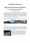
ISPRS Technical Commission V Symposium "Close-range imaging, ranging and applications" ... more ISPRS Technical Commission V Symposium "Close-range imaging, ranging and applications" TIF Travel Grant Report by Ana Djuricic I am taking this opportunity to share my experience and impressions from ISPRS Technical Commission V Symposium. I am a PhD student in Photogrammetry, Department of Geodesy and Geoinformation, Vienna University of Technology where I am involved in the project "Smart-Geology for the World's largest fossil oyster reef" in cooperation with Natural History Museum Vienna (NHM). For me this was the first time to attend the ISPRS Symposium. I was very happy to have been there. It is a great pleasure and honour. I worked very hard in order to prepare my contribution with colleagues from Karlsruhe Institute of Technology (KIT), Germany. When I arrived there the feeling was just "WOW!" The place where symposium was held is such a beautiful place in north part of Italy – Riva del Garda! Pre-Symposium The first day, Sunday morning and a...
The description and evaluation of geological, sedimentary and paleontological features in the fie... more The description and evaluation of geological, sedimentary and paleontological features in the field is often rather subjective. Many conclusions are based on view measurements on subjectively chosen elements, thought to be representative for the entire setting. One method to overcome this problem is the data acquisition by terrestrial laser scanning, which provides objective data sets. Here we present a key study conducted on the unique fossil oyster reef at Stetten in Lower Austria. The 400-m 2 -large site presents the world's largest fossil oyster biostrome with about 15.000 up to 80-cm-long shells. Despite the excellent preservation and accessibility, the analysis of this spectacular taphocenosis is still missing. No data on orientation, taphonomic grades, distribution and sorting are available. In a first step, a Terrestrial Laserscanner (TLS) was used for the determination of the geometrical 3D structures. The respective area is represented by a "raw" point cloud ...
We present the first analysis of population structure and cohort distribution in a fossil oyster ... more We present the first analysis of population structure and cohort distribution in a fossil oyster shell bed based on 1121 shells of the giant oyster Crassostrea gryphoides (von Schlotheim, 1813). Data derive from terrestrial laser scanning of a Lower Miocene shell bed covering 459 m 2. Within two transects, individual shells were manually outlined on a digital surface model and cross-checked based on high-resolution orthophotos, resulting in accurate information on center line length and area of exposed shell surface. A growth model was calculated, revealing this species as the fastest growing and largest Crassostrea known so far. Non-normal distribution of size, area and age data hints at the presence of at least four distinct recruitment cohorts. The rapid decline of frequency amplitudes with age is interpreted to be a function of mortality and shell loss. The calculated shell half-lives range around a few years, indicating that oyster reefs were geologically short-lived structures, which could have been fully degraded on a decadal scale. Crassostrea gryphoides reefs were widespread and common along the Miocene circum-Tethyan coasts. Given its enormous growth performance of ∼ 150 g carbonate per year this species has been an important carbonate producer in es-tuarine settings. Yet, the rapid shell loss impeded the formation of stable structures comparable to coral reefs.


Uploads
Papers by Ana Djuricic (Puttonen)
scanning technology has a high potential for providing precise 3D mapping that serves as the basis for automatic object detection in different scenarios; however, it faces challenges in the presence of large amounts of data and the irregular geometry of an oyster reef. We provide a detailed description of the techniques and strategy used for data collection and processing. The use of laser scanning provided the ability to measure surface points of 46,840 (estimated) shells. They are up to 60-cm-long oyster specimens, and their surfaces are modeled with a high accuracy of 1 mm. In addition, we propose an automatic analysis method for identifying and enumerating convex parts of shells. Object surfaces were detected with a completeness of 69% and a correctness
of over 75% by means of a fully automated workflow. Accuracy of 98%
was achieved in detecting the number of objects. In addition to laser scanning measurements, more than 300 photographs were captured, and an orthophoto mosaic was generated with a ground sampling distance (GSD) of 0.5 mm. This high-resolution 3D information and the photographic texture serve as the basis for ongoing and future geological and paleontological analyses. Moreover, they provide unprecedented documentation for conservation issues at a unique
natural heritage site.