Papers by João Luís Cardoso

Setúbal Arqueológica, 1978
Datam de 1969 as nossas primeiras pesquisas nos arredores de Belver (Concelho de Gavião). Até ago... more Datam de 1969 as nossas primeiras pesquisas nos arredores de Belver (Concelho de Gavião). Até agora recolhemos algumas peças paleolíticas bastante dispersas nas áreas de Martins, Vale da Santa e Alvisquer e também nos terraços fluviais a jusante da Barragem de Belver (4). A jazida de Vale da Fonte é a mais importante de todas e aquela que será objecto deste trabalho. Localizada em Março de 1973, situa-se num amplo planalto terciário - «charneca», constituído por abundantes cascalheiras, desenvolvendo-se a cerca de 200 m acima do Tejo, neste sector com 40 m de cota. Ao contrário das outras, as peças desta jazida encontravam-se menos dispersas, numa área de contorno mal definido com aproximadamente 400 m de comprimento por 150 m de largura máxima e a cerca de 500 m SE do marco geodésico da Torre. O seu estudo revelou-nos a existência de um conjunto bastante homogéneo, representado por duas séries.
MAINAKE, Anejo nº 4, 2024
Neste artigo estudam-se os restos faunísticos da primeira fase urbana da ocupação fenícia de La R... more Neste artigo estudam-se os restos faunísticos da primeira fase urbana da ocupação fenícia de La Rebanadilla (Málaga), correspondendo à Fase IV, dos finais do séc. IX a.C., provenientes de um conjunto de fossas escavadas no substrato natural. Observou-se claro predomínio de animais domésticos, representados, por ordem decrescente, pelos caprinos (ovelhas e cabras) e boi doméstico. Residualmente identificaram-se outros animais de grande, médio e pequeno porte: porco/javali, auroque, cavalo e coelho. Foram observadas acções antrópicas, tais como marcas de corte e vestígios de fogo bem como outras modificações presentes na superfície dos ossos.
A comparação destes resultados faunísticos com os obtidos em outras estações arqueológicas da mesma época evidencia o domínio dos animais domésticos na economia destas populações, e consequentemente o escasso aproveitamento dos recursos cinegéticos, revelador de comunidades estáveis e complexas, com uma economia de produção especializada.

O Arqueólogo Português, 2024
Este artigo resultou da fusão de duas comunicações distintas apresentadas na segunda sessão do ci... more Este artigo resultou da fusão de duas comunicações distintas apresentadas na segunda sessão do ciclo de conferências Lisboa não é só Subterrânea — 25 anos depois de uma exposição, ocorrida no dia 4 de maio de 2019: «Depois de 1993: o que mudou na Pré-História de Lisboa», da autoria de um dos signatários (J. L. C.), e «Unir os pontos: uma abordagem geoespacial dos vestígios neolíticos e calcolíticos na cidade de Lisboa», da autoria dos restantes signatários. / Abstract: This article resulted from the fusion of two distinct communications presented in the second session of the conference cycle Lisbon is not just Underground — 25 years after an exhibition, which took place on May 4, 2019: «After 1993: what changed in the Prehistory of Lisbon», written by one of the signatories (J. L. C.), and «Joining the dots: a geospatial approach to Neolithic and Chalcolithic remains in the city of Lisbon", written by the remaining signatories.
Al-madan online, 2025
Artigo dedicado à evocação de José Pires Gonçalves (1908-1984), médico de formação que dedicou bo... more Artigo dedicado à evocação de José Pires Gonçalves (1908-1984), médico de formação que dedicou boa parte do seu tempo à investigação da História e do Património artístico e arqueológico da região de Reguengos de Monsaraz.
No plano da Arqueologia, a sua atenção centrou-se essencialmente nos menires, antas e cromeleques do Alentejo, num trabalho militante, esforçado, consequente e, sobretudo, desinteressado, a que José Pires Gonçalves se entregou de corpo e alma ao longo da sua vida. /
ABSTRACT:
This article is dedicated to the memory of José Pires Gonçalves (1908-1984), a trained doctor who dedicated much of his time to researching the History and artistic and archaeological Heritage of the Reguengos de Monsaraz region.
In terms of archaeology, his focus was essentially on the menhirs, dolmens and cromlechs of the Alentejo, a militant, hard-working, consistent and, above all, selfless endeavour to which José Pires Gonçalves devoted himself body and soul throughout his life. /
RÉSUMÉ:
Article dédié à l’évocation de José Pires Gonçalves (1908-1984), médecin de formation qui a employé unebonne partie de son temps dans la recherche de l’Histoire et du Patrimoine artistique et archéologique de la région de Reguengos de Monsaraz.
Sur le plan de l’Archéologie, son attention s’est focalisée essentiellement sur les menhirs, dolmens et cromlechs de l’Alentejo, dans un travail militant, poussé, conséquent et, surtout, désintéressé, dans lequel José Pires Gonçalves s’est investi corps et âme tout au long de sa vie.
Al-madan, 2024
RESUMO:
Os autores abordam a importância das antas no imaginário popular e erudito das comunidade... more RESUMO:
Os autores abordam a importância das antas no imaginário popular e erudito das comunidades portuguesas, muito anterior ao reconhecimento da sua relevância científica e valor arqueológico. Essa importância é evidenciada na toponímia antiga, onde abundam termos derivados da estrutura dos monumentos megalíticos ou dos montículos que, por vezes, ainda os cobriam.
São sublinhadas as primeiras publicações científicas dedicadas ao tema, onde se destaca o pioneirismo de Francisco Pereira da Costa, que em 1868 descreve os resultados de escavações realizadas em antas na região de Castelo de Vide. / ABSTRACT:
The authors deal with the importance of tombs in the popular and academic imagination of portuguese communities, which is much prior to the recognition of their scientific relevance and archaeological value. That importance is clear in old toponymy, with many words derived from the structure of megalithic monuments and the mounds that sometimes covered them.
The authors highlights the first scientific publications dedicated to the theme, among which those of the pioneer Francisco Pereira da Costa, who, in 1868, described the results of excavations carried out in tombs in Castelo de Vide.
Al-madan, 2024
1. Desenho de materiais arqueológicos e preparação de materiais scripto, gráficos e de multimédia... more 1. Desenho de materiais arqueológicos e preparação de materiais scripto, gráficos e de multimédia
2. Investigações arqueológicas de campo e de gabinete sobre o Património arqueológico oeirense
3. Revista “Estudos Arqueológicos de Oeiras”
4. Apresentação do volume 31 da revista “Estudos Arqueológicos de Oeiras” (2022)
5. Visitas guiadas
6. Outras colaborações
7. Terceira Edição do Prémio de Arqueologia Professor Doutor Octávio da Veiga Ferreira
8. Distinções
Ciência e Cultura, 2024
RESUMO:
Os monumentos megalíticos marcaram de forma indelével a paisagem do território actualment... more RESUMO:
Os monumentos megalíticos marcaram de forma indelével a paisagem do território actualmente português, constituindo um sinal de perenidade através dos tempos. Este sentido de permanência conduziu à sua utilização como marcos territoriais ao longo dos tempos, especialmente em épocas de verdadeira “refundação” da paisagem. Pretende-se aqui compilar diversos exemplos de época medieval do território alto-alentejano, onde, fosse na definição dos termos municipais ou na delimitação fundiária das grandes propriedades, foram tais monumentos assim utilizados, demonstrando o aproveitamento daquelas estruturas ancestrais para finalidades práticas, dada a sua visibilidade na paisagem e as particularidades que os individualizavam. No final, aborda-se um “caso de estudo” com base em observações mais recentes, de natureza religiosa que abrirá o caminho para a futura “Arqueologia”.
Palavras-chave: antas; marcadores simbólicos; paisagens medievais. /
ABSTRACT:
Megalithic monuments have left an indelible mark on the landscape of what is now Portugal, constituting a sign of permanence throughout time. This sense of permanence has led to their use as territorial landmarks throughout time, especially in periods of true “refoundation” of the landscape. The aim here is to compile several examples from the medieval period in the Alto Alentejo region, where, whether in the definition of municipal boundaries or in the land demarcation of large properties, such monuments were used in this way, demonstrating the use of these ancestral structures for practical purposes, given their visibility in the landscape and the particularities that individualized them. Finally, a “case study” is addressed based on more recent observations, of a religious nature, which will pave the way for future “Archaeology”.
Keywords: dolmens; symbolic markers; medieval landscapes
Archaeopress Archaeology, 2024
The three major walled sites where the author conducted archaeological excavations - Leceia (Oeir... more The three major walled sites where the author conducted archaeological excavations - Leceia (Oeiras), between 1983 and 2002; Moita da Ladra (Vila Franca de Xira), between 2003 and 2006; and Outeiro Redondo (Sesimbra), between 2005 and 2016 - yielded a body of information of unquestionable relevance to our knowledge of architectures, stratigraphies and absolute datings. This data became essential for understanding the economy and social organisation of the populations that occupied this vast region, with its own cultural significance: the socalled ‘Chalcolithic of Extremadura’. In addition to this remarkable wealth of information, the exhumed archaeological remains have been thoroughly studied and published in detail.
This paper will describe the main architectural features, both defensive and residential, of each site. Moreover, the archaeological assemblages will be enhanced based on the identification of artefacts that, given their typology, could provide objective information about the most relevant economic activities carried out by the sites’ inhabitants. Such conclusions, combined with the sites’ features, including their geographical location and size, led, for the first time, to conclusions on their functional nature and how they fitted into the demographic and economic fabric of the densely populated Lisbon/Setúbal peninsulas during the 3rd millennium BC.
Keywords: Leceia, Moita da Ladra, Outeiro Redondo; architectures; assemblages; functionalities; ‘Chalcolithic of Extremadura’; Portugal.
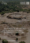
estudos & memórias, 2024
The three first-rate walled sites where the author directed archaeological excavations: Leceia (O... more The three first-rate walled sites where the author directed archaeological excavations: Leceia (Oeiras), between 1983 and 2002; Moita da Ladra (Vila Franca de Xira), between 2003 and 2006; and Outeiro Redondo (Sesimbra), between 2005 and 2016, produced a set of information of unavoidable relevance about architectures, stratigraphies, and absolute chronology, thus becoming essential for the knowledge of the economy and social organization of the populations that occupied the region, with its own cultural significance: the so-called “Chalcolithic of Extremadura”. To this remarkable information, was added that concerning the archaeological remains, which are currently fully studied and published in detail.
In this communication, after presenting the main architectural characteristics, stratigraphic sequence and absolute chronology of each of them, the archaeological remains were valued by identifying the artefacts that, due to their typology, provide objective information about the most relevant activities developed by the respective inhabitants. Such conclusions, articulated with the characteristics of the sites themselves, including their geographic location and dimensions, led, for the first time, to conclusions about its functionality and the way in which they were part of the demographic and economic fabric of the peninsulas of Lisbon/ Setúbal during the 3rd millennium BC, already densely populated at that time.

Thesaurus de Ciências da Terra, 2023
Estratigrafia II-Quadros das Divisões Estratigráficas XI Nota preambular Designar por "tesouro" u... more Estratigrafia II-Quadros das Divisões Estratigráficas XI Nota preambular Designar por "tesouro" um acervo de vocábulos ou termos possui um alcance que vai muito além do mero significado das palavras, se consentida é a redundância. Thesaurus é a transliteração latina da palavra grega com a mesma forma. Era a designação dada a um lugar onde se recolhiam bens preciosos, um depósito, portanto, ou repositório, cuja marca distintiva era o valor daquilo que nele se recolhia. Daí a evolução quase linear para a sua dimensão semântica, que ainda hoje mantém, de "tesouro". Mas é justamente aí, nessa dimensão, que ganha especial significado o facto de se chamar thesaurus ou "tesouro" a um acervo de palavras; sinal inequívoco da riqueza que nelas se contém ou, talvez com mais propriedade, da riqueza que elas, as palavras, constituem. Do bem precioso, no fim de contas, que são esses instrumentos primordiais da comunicação. Daí terse convencionado chamar Thesaurus ao acervo de termos específicos de uma determinada ciência; e não é razão para menos, porque no rigor das palavras e da significação que possuem reside, em boa verdade, parte da riqueza dessas mesmas ciências. No caso específico das chamadas (e com razão) "ciências da terra", a organização dos seus thesauri ou repositórios vocabulares, no quadro da Academia das Ciências de Lisboa, teve o seu início em 2015, com a publicação da parte respeitante à Petrologia e Geoquímica Orgânicas. Seguiram-se, em regular sequência, a Petrologia das Rochas Ígneas e Geoquímica
Thesaurus de Ciências da Terra, 2023
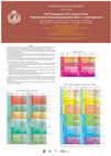
The Academy of Sciences of Lisbon conducted an extensive study to establish an updated Portuguese... more The Academy of Sciences of Lisbon conducted an extensive study to establish an updated Portuguese (PT) terminology for chronostratigraphic/geochronologic units of selected Geological Timetables. The study, coordinated by M.J. Lemos de Sousa and Ana Salgado, was developed by a joint task force between the Earth and Space Sciences section of the Class of Sciences and the Institute of Lexicology and Lexicography of the Academy. In addition to establishing an updated terminology in the subdomain of Stratigraphy, the study should also be regarded as a valuable contribution to the Academy’s newly developed Dictionary and Vocabulary, which is currently available online. In pursuit of this objective, the authors considered the mandatory rules of both the International Stratigraphic Guide (Salvador 1994, reapproved 2013), and the erudite norm of the Portuguese language variety. The following Geological Timetables were considered in the study: • International Geological Timetable, usually referred to as the “standard” or “global” table, published by the International Union of Geological Sciences/International Commission on Stratigraphy as the “International Chronostratigraphic Chart”. • Detailed Geological Timetable of the Quaternary, traditionally considered as a complementary chart of the global one. • Geologic Timetable of the Bohemo-Iberian Ordovician regional chronostratigraphic units, specifically needed for the classification of Portuguese Ordovician units. • Geologic Timetable of the West European Carboniferous regional chronostratigraphic units, specifically needed for the classification of Iberian terrestrial Carboniferous units. In this poster, the authors present the “International Chronostratigraphic Chart” in both English and its corresponding new version in Portuguese (PT). In cases where linguistic rules allowed for the validation of various Portuguese orthographic variants, the variant used in the general table corresponds to the preferred form. The study was financed by Fundação Fernando Pessoa, Câmara Municipal de Oeiras and Fundação para a Ciência e a Tecnologia.
Thesaurus de Ciências da Terra, 2023
Folheto
Thesaurus de Ciências da Terra, 2023
Memórias da Academia das Ciências de Lisboa - Classe de Ciências, 2024
This study addressed all the Early Neolithic mammal remains recovered from Encosta de Sant’Ana du... more This study addressed all the Early Neolithic mammal remains recovered from Encosta de Sant’Ana during the excavations conducted between 2004 and 2006, mainly from Sector E. The faunal record studied in this paper suggests that this was a community that occupied the site on a seasonal basis, as indicated by the considerable amount of hunted fauna. Rabbits are particularly noteworthy, followed by deer and possibly wild boar and, although to a much lesser extent, aurochs, suggesting territories that were essentially forest or Mediterranean scrubland, with occasional open spaces. As far as domestic cattle are concerned, the scarcity of bovines is also indicative of limited sedentation.
Memórias da Academia das Ciências de Lisboa - Classe de Ciências, 2024
Brief presentation of the theme addressing the history of investigations carried out in Portugal ... more Brief presentation of the theme addressing the history of investigations carried out in Portugal about the presence of Neanderthals, the sites with anhtropological and archaeological record and their antiquity. Considering their close resemblance with our own species and long‑term success across Eurasia, Neanderthals ought to have had all it takes to persist. However, sometime between c. 45,000 and 30,000 years ago, Neanderthals ultimately disappear from the archaeological record, being replaced by modern humans. This cultural and biological replacement process is considered one of the most significant turning points in human evolutionary history. In recent years, knowledge of the processes involved in the disappearance of the Neanderthals and the successful expansion of our species across Eurasia has substantially increased. Still, the spatiotemporal variability of the presumed mechanisms behind Neanderthals’ demise – climate change, fragile demography, inter‑species competition – makes evaluating the replacement at a continental scale very challenging. The Iberian Peninsula, due to its cul‑de‑sac position and the role of its southern regions as one of the last refugia for the Neanderthals, represents an ideal natural setting for testing models of cultural and demographic trajectories leading to the final disappearance of those populations. Focusing on the Iberian archaeological record, in this paper we address the current state of the art and future directions regarding the study of the latest Neanderthals on earth.

Conference: XXXIX Jornadas de la Sociedad Española de Paleontología (2 al 5 de octubre de 2024) en Coruña, 22 pág, 2024
The pantherine partial skeleton from the Algar da Manga Larga (MG1355.0001-9), was discovered at ... more The pantherine partial skeleton from the Algar da Manga Larga (MG1355.0001-9), was discovered at the Natural Park of Serras d´Aire e Candeeiros and published in 2006. It comprises a nearly complete cranium and mandible, a damaged distal half of right humerus, a complete left metacarpal III, proximal epiphyses of left metacarpals II and IV and three damaged cervical vertebrae. The nearly pristine conservation of the skull makes it a perfect candidate for the virtual reconstruction of the cranial cavities. Both cranium and hemimandibles were scanned through a medical CT-scan. The resulting data was segmented with the help of the software 3DSlicer 5.6.1 in order to virtually extract the endocast (cerebrum + cerebellum + brain stem). This was a time-consuming process due to the clay adhered to the inner walls of the cranium, which obscured the real volume of the cranial cavity, as well as the collapsed bone in some areas of the interior of the cranium. The resulting endocast of the leopard of Manga Larga has been preliminary morphologically compared with the endocast of a modern African leopard, revealing some interesting differences in the overall structure. The Manga Larga specimen presents a dorso-ventral torsion of the telencephalon relative to the brain stem, while the modern African leopard presents a more antero-posteriorly straight brain cavity, revealing also a relatively more ventral position of the foramen magnum in the specimen from Manga Larga. Further work on this specimen is necessary to clarify the implications of these differences, including the virtual reconstruction of the frontal sinuses, the study of the cranial and postcranial skeleton with both traditional and geometric morphometrics and the use molecular techniques to clarify its age and details about its ecology.
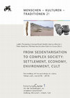
Menschen-Kulturen-Traditionen, 21: 53-63, 2024
The Early Neolithic site of Carrascal is located on a soft slope of the valley of Barcarena (muni... more The Early Neolithic site of Carrascal is located on a soft slope of the valley of Barcarena (municipality of Oeiras, district of Lisbon), about 3 km from the northern margin of the Tagus estuary, and in the vicinity of a paleo-estuary located downhill and supplying an abundant collector activity, namely of oysters (Ostrea edulis).
The abundance of cores and flakes recovered and the occurrence of silex in the cretaceous recifal limestones that exist around the site, is compatible with the inference of an important workshop; likewise, the production of polished stone artefacts made essentially with rocks of local origin has been proven; and, in the register of ceramic productions, with decorations typical of the Early Neolithic – incised and printed – large vessels occur, for the storage of various products, such as cereals. In effect, a manual millstone was collected, still in its original position. The faunal remains are rich and diversified, with the following taxa present: Bos primigenius; Bos taurus; Sus sp. and Ovis aries, showing the abundance of domestic animals as well as wild game. Finally, domestic structures are represented essentially by two cuvettes, excavated in the geological substrate, filled with basalt blocks collected in the vicinity, corresponding to fireplaces.
Together, the abundance and diversity of the remains found indicates a perennial establishment corresponding to an important occupation dating to the last quarter of the 6th millennium BC, according to the six radiocarbon dates performed on faunal remains.
This study presents a review of the large-sized mammals from the Upper Pleistocene of portuguese ... more This study presents a review of the large-sized mammals from the Upper Pleistocene of portuguese caves situated at the Hesperic basement. At the moment, only two caves are known: the Lorga de Dine cave (Vinhais, Braganc.;a) and Escoural cave (Montemor-o-Novo, Ivora). Both were excavated at the sixteens and no stratigraphic or horizontal records are published. The presence ofCrocuta crocuta intermedia at Lorga de Dine allows us to suppose an occupation ofthe cave during the Mindel-Riss; in that case, it will be the oldest cavity with palaeontological interest known in Portugal. Nevertheless, we must admit the role ofthe Iberian Peninsula as a refuge-territory, that couldjustify the presence of several species, later than is known elsewere in Europe. Escoural cave - the most occidental cave with parietal pleistocene art - gave the only Cuon alpinus europaeus remains known at present in Portugal. Considering the large majority or even the totality ofthe remains relate to the Late W urm...
Estudos do Quaternário / Quaternary Studies, 1999
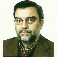
Georges Zbyszewski, de nacionalidade francesa, mas de origem russa, nasceu a 22 de Outubro de 190... more Georges Zbyszewski, de nacionalidade francesa, mas de origem russa, nasceu a 22 de Outubro de 1909 efaleceu em Lisboa a 1 de Março de 1999. Esta curta evocação destina-se a homenagear o eminentegeólogo, paleontólogo e arqueólogo, que em Portugal desenvolveu quase toda a sua actividade científica.




Uploads
Papers by João Luís Cardoso
A comparação destes resultados faunísticos com os obtidos em outras estações arqueológicas da mesma época evidencia o domínio dos animais domésticos na economia destas populações, e consequentemente o escasso aproveitamento dos recursos cinegéticos, revelador de comunidades estáveis e complexas, com uma economia de produção especializada.
No plano da Arqueologia, a sua atenção centrou-se essencialmente nos menires, antas e cromeleques do Alentejo, num trabalho militante, esforçado, consequente e, sobretudo, desinteressado, a que José Pires Gonçalves se entregou de corpo e alma ao longo da sua vida. /
ABSTRACT:
This article is dedicated to the memory of José Pires Gonçalves (1908-1984), a trained doctor who dedicated much of his time to researching the History and artistic and archaeological Heritage of the Reguengos de Monsaraz region.
In terms of archaeology, his focus was essentially on the menhirs, dolmens and cromlechs of the Alentejo, a militant, hard-working, consistent and, above all, selfless endeavour to which José Pires Gonçalves devoted himself body and soul throughout his life. /
RÉSUMÉ:
Article dédié à l’évocation de José Pires Gonçalves (1908-1984), médecin de formation qui a employé unebonne partie de son temps dans la recherche de l’Histoire et du Patrimoine artistique et archéologique de la région de Reguengos de Monsaraz.
Sur le plan de l’Archéologie, son attention s’est focalisée essentiellement sur les menhirs, dolmens et cromlechs de l’Alentejo, dans un travail militant, poussé, conséquent et, surtout, désintéressé, dans lequel José Pires Gonçalves s’est investi corps et âme tout au long de sa vie.
Os autores abordam a importância das antas no imaginário popular e erudito das comunidades portuguesas, muito anterior ao reconhecimento da sua relevância científica e valor arqueológico. Essa importância é evidenciada na toponímia antiga, onde abundam termos derivados da estrutura dos monumentos megalíticos ou dos montículos que, por vezes, ainda os cobriam.
São sublinhadas as primeiras publicações científicas dedicadas ao tema, onde se destaca o pioneirismo de Francisco Pereira da Costa, que em 1868 descreve os resultados de escavações realizadas em antas na região de Castelo de Vide. / ABSTRACT:
The authors deal with the importance of tombs in the popular and academic imagination of portuguese communities, which is much prior to the recognition of their scientific relevance and archaeological value. That importance is clear in old toponymy, with many words derived from the structure of megalithic monuments and the mounds that sometimes covered them.
The authors highlights the first scientific publications dedicated to the theme, among which those of the pioneer Francisco Pereira da Costa, who, in 1868, described the results of excavations carried out in tombs in Castelo de Vide.
2. Investigações arqueológicas de campo e de gabinete sobre o Património arqueológico oeirense
3. Revista “Estudos Arqueológicos de Oeiras”
4. Apresentação do volume 31 da revista “Estudos Arqueológicos de Oeiras” (2022)
5. Visitas guiadas
6. Outras colaborações
7. Terceira Edição do Prémio de Arqueologia Professor Doutor Octávio da Veiga Ferreira
8. Distinções
Os monumentos megalíticos marcaram de forma indelével a paisagem do território actualmente português, constituindo um sinal de perenidade através dos tempos. Este sentido de permanência conduziu à sua utilização como marcos territoriais ao longo dos tempos, especialmente em épocas de verdadeira “refundação” da paisagem. Pretende-se aqui compilar diversos exemplos de época medieval do território alto-alentejano, onde, fosse na definição dos termos municipais ou na delimitação fundiária das grandes propriedades, foram tais monumentos assim utilizados, demonstrando o aproveitamento daquelas estruturas ancestrais para finalidades práticas, dada a sua visibilidade na paisagem e as particularidades que os individualizavam. No final, aborda-se um “caso de estudo” com base em observações mais recentes, de natureza religiosa que abrirá o caminho para a futura “Arqueologia”.
Palavras-chave: antas; marcadores simbólicos; paisagens medievais. /
ABSTRACT:
Megalithic monuments have left an indelible mark on the landscape of what is now Portugal, constituting a sign of permanence throughout time. This sense of permanence has led to their use as territorial landmarks throughout time, especially in periods of true “refoundation” of the landscape. The aim here is to compile several examples from the medieval period in the Alto Alentejo region, where, whether in the definition of municipal boundaries or in the land demarcation of large properties, such monuments were used in this way, demonstrating the use of these ancestral structures for practical purposes, given their visibility in the landscape and the particularities that individualized them. Finally, a “case study” is addressed based on more recent observations, of a religious nature, which will pave the way for future “Archaeology”.
Keywords: dolmens; symbolic markers; medieval landscapes
This paper will describe the main architectural features, both defensive and residential, of each site. Moreover, the archaeological assemblages will be enhanced based on the identification of artefacts that, given their typology, could provide objective information about the most relevant economic activities carried out by the sites’ inhabitants. Such conclusions, combined with the sites’ features, including their geographical location and size, led, for the first time, to conclusions on their functional nature and how they fitted into the demographic and economic fabric of the densely populated Lisbon/Setúbal peninsulas during the 3rd millennium BC.
Keywords: Leceia, Moita da Ladra, Outeiro Redondo; architectures; assemblages; functionalities; ‘Chalcolithic of Extremadura’; Portugal.
In this communication, after presenting the main architectural characteristics, stratigraphic sequence and absolute chronology of each of them, the archaeological remains were valued by identifying the artefacts that, due to their typology, provide objective information about the most relevant activities developed by the respective inhabitants. Such conclusions, articulated with the characteristics of the sites themselves, including their geographic location and dimensions, led, for the first time, to conclusions about its functionality and the way in which they were part of the demographic and economic fabric of the peninsulas of Lisbon/ Setúbal during the 3rd millennium BC, already densely populated at that time.
The abundance of cores and flakes recovered and the occurrence of silex in the cretaceous recifal limestones that exist around the site, is compatible with the inference of an important workshop; likewise, the production of polished stone artefacts made essentially with rocks of local origin has been proven; and, in the register of ceramic productions, with decorations typical of the Early Neolithic – incised and printed – large vessels occur, for the storage of various products, such as cereals. In effect, a manual millstone was collected, still in its original position. The faunal remains are rich and diversified, with the following taxa present: Bos primigenius; Bos taurus; Sus sp. and Ovis aries, showing the abundance of domestic animals as well as wild game. Finally, domestic structures are represented essentially by two cuvettes, excavated in the geological substrate, filled with basalt blocks collected in the vicinity, corresponding to fireplaces.
Together, the abundance and diversity of the remains found indicates a perennial establishment corresponding to an important occupation dating to the last quarter of the 6th millennium BC, according to the six radiocarbon dates performed on faunal remains.
Remontagens de um conjunto de núcleos de sílex do Neolítico Antigo do povoado da Encosta de Sant’Ana (Lisboa); MIGUEL ROCHA, NUNO NETO, PAULO REBELO, FILIPE MARTINS & JOÃO LUÍS CARDOSO - O Complexo do Neolítico Final e do Calcolítico da Travessa das Dores/Rio Seco (Ajuda – Lisboa): resultados das escavações realizadas no sector do Rio Seco (2017/2018); JOÃO LUÍS CARDOSO & FILIPE MARTINS - A Lapa da Bugalheira (Torres Novas): revisão dos espólios recuperados na intervenção arqueológica ali realizada em 1941; JOÃO LUÍS CARDOSO - Mineração, circulação e transformação de produtos geológicos não metálicos no Neolítico e no Calcolítico do Ocidente peninsular; CATARINA COSTEIRA, EDUARDO PORFÍRIO, JOÃO LUÍS CARDOSO, ANA MARIA COSTA & TERESA SIMÕES - O monumento pré‑histórico da Praia das Maçãs: leitura comparada dos dados da escavação arqueológica realizada em 1961 e das intervenções arqueológicas de 2020‑2022; ANA ÁVILA DE MELO, RAQUEL VILAÇA & JOÃO LUÍS CARDOSO - Alfinetes da Idade do Bronze e da transição para a Idade do Ferro no território português; JOÃO LUÍS CARDOSO - Leonardo Turriano e a produção fabril em Portugal no primeiro quartel do século XVII: o seu contributo no complexo tecnológico‑militar de Barcarena (Oeiras), com base na documentação compulsada e nas escavações arqueológicas realizadas; RAFAEL MOREIRA - Leonardo Turriano em Oeiras; CENTRO DE ESTUDOS ARQUEOLÓGICOS DO CONCELHO DE OEIRAS - Relatório das actividades desenvolvidas em 2022
Considering their close resemblance with our own species and long‑term success across Eurasia, Neanderthals ought to have had all it takes to persist. However, sometime between c. 45,000 and 30,000 years ago, Neanderthals ultimately disappear from the archaeological record, being replaced by modern humans. This cultural and biological replacement process is considered one of the most significant turning points in human evolutionary history. In recent years, knowledge of the processes involved in the disappearance of the Neanderthals and the successful expansion of our species across Eurasia has substantially increased. Still, the spatiotemporal variability of the presumed mechanisms behind Neanderthals’ demise – climate change, fragile demography, inter‑species competition – makes evaluating the replacement at a continental scale very challenging. The Iberian Peninsula, due to its cul‑de‑sac position and the role of its southern regions as one of the last refugia for the Neanderthals, represents an ideal natural setting for testing models of cultural and demographic trajectories leading to the final disappearance of those populations. Focusing on the Iberian archaeological record, in this paper we address the current state of the art and future directions regarding the study of the latest Neanderthals on earth.
The dolmen of Monte Serves, located in Vila Franca de Xira (Lisbon peninsula), corresponds to a small megalithic tomb with a trapezoidal plan built using limestone slabs. It was identified in 1972 by Octávio da Veiga Ferreira, being excavated that same year under the direction of Christopher Thomas North. In 2014, within the scope of the project MEGAGEO – Moving Megaliths in the Neolithic, this monument was the subject of new archaeological works, directed by Rui Boaventura and João Luís Cardoso, intending to define its specific architecture and the respective construction sequences, mainly regarding the Tumulus and the Atrium areas. Despite the practical absence of votive materials, it was possible to collect human osteological samples, thus allowing to perform radiocarbon dating – whose average result places at least one use episode of this tomb (not necessarily its first) in the transition from the first to the second quarter of the 3rd millennium BCE (median probability: 2706 cal BCE 2σ; mean: 2715 cal BCE 2σ). Indeed, this result differs greatly from the chronological framework established for this type of small tombs in Southwestern Iberia (mid‑4th millennium BCE), but is close to the chronology (relative and absolute) documented in the contiguous funerary contexts of Casal do Penedo and Verdelha dos Ruivos, as well as in the settlements of Moita da Ladra and Pedreira do Casal do Penedo, culturally included in the typical Chalcolithic of Portuguese Estremadura. This paper thus intends to present the results obtained with the excavation of this small tomb, in terms of its architecture and chronology, framing it within the socio‑cultural dynamics documented in Lower Extremadura during the Neolithic and Chalcolithic, mainly regarding the origin and development of the megalithic phenomenon.
The aim of this petroarchaeological study was to identify, from a diachronic perspective, between the Late Neolithic and the Middle/Late Chalcolithic, the types of flint used for the manufacture of lithic products in the prehistoric settlement of Leceia, based on the remains found during excavations carried out between 1983 and 2002, and the types of flint observed in the two workshops located in the vicinity of Leceia – Monte do Castelo and Barotas.
The construction of a local geological reference of flint has contributed to a more detailed knowledge of the siliceous microfacies of the Bica Formation (Cenomanian) on the Lisbon Peninsula.
The correlation of flint samples from archaeological materials with the raw material from potential supply areas, at local and regional level, made it possible to configure a territory of direct supply of flint, collected in local source areas, in primary and secondary formations (alluvium of the Barcarena stream), and also in the form of debitage products produced in Barotas and Monte do Castelo. Leceia would have played a role as an aggregation site, especially from the Early Chalcolithic onwards, with influence on the specialised sites of Barotas and Monte do Castelo, which would have operated in its dependency.
In addition to local networks, regional supply networks have been identified, both to the north‑northeast and to the south‑southeast of the peninsula, where finished objects – blades and/or arrowheads – circulated and arrived at Leceia, probably in exchange for local raw materials. Leceia’s involvement in long‑distance exchange networks is confirmed by the presence of exogenous objects, such as oolitic flint blades from Andalusia.
In this article, we analyse faunal samples from the Late Neolithic (Layer 4) and Early Chalcolithic (Layer 3) levels of the fortified settlement of Leceia (Oeiras, Portugal) in order to understand the management of the feeding of domestic animals recovered in these excavations.
Through the analyses of stable isotopes of δ13C and δ15N in bone collagen, we aim to characterise the grazing systems and the maintenance strategies of the livestock that were consumed and raised in Leceia, in an attempt to obtain a further perspective on the economic complexity of the fortified settlements that emerged during the 3rd millennium in Portuguese Extremadura. The results show the possible use of forage to feed the animals and also seem to indicate the use of fertilised fields. This demonstrates that animal production is already based on intentional practices of animal and land management, as well as on complex exchange networks.
The Verdelha dos Ruivos cave, located around 20 km NNE of Lisbon, is the only necropolis of the Bell Beaker Complex identified in Portugal to date in which it was possible to isolate in a stratigraphic sequence, single burials and reconstruct the original position of the corpses.
The cave was occasionally identified in 1973, during the inspection of a Cretaceous limestone quarry, whose exploration front sectioned the cavity, leaving only the distal part of it.
The excavation was carried out by a team from the Geological Service of Portugal led by O. da Veiga Ferreira, which included a medicine doctor, which constituted an obvious added value for characterizing the composition of the population and knowledge of the methods of inhumation used.
The small crypt that remained of the primitive natural cavity, whose brown filling contrasted with the color of the limestone, was completely emptied by an hardened carbonate breccia, with abundant limestone blocks, containing archaeological remains. The hardness of this very consolidated filling made it difficult to carry out the excavation, which began in October 1973 and ended only in May 1974.
Three main levels were identified, consisting of successive individual tombs in dorsal decubitus, on the left or right side, with the body retracted, in the uterine position. It was possible to identify the position of 11 graves, some related with limestone slabs, which constituted the base or covering of the graves.
The archaeological remains included all the items considered characteristic of Bell Beaker Complex: sperm whale tooth buttons, gold spirals, a Palmela point, a fragment of a wristguard and ceramics, of which the decorated ones belong exclusively to the Bell Beker Complex, which leads to the conclusion that the funerary use of the cave is exclusively from a community related to this cultural “circle”.
The absolute dating carried out allowed us to place the beginning of this necropolis between 2700 and 2600 years BC, extending into the second half of the 3rd millennium BC. These results are consistent with the antiquity of the emergence of the Bell Beaker Complex in the Tagus estuary region, as was demonstrated by the results obtained at the prehistoric settlement of Leceia, located approximately 30 km to the SW, a reality that will be also valued and discussed.
The paper discusses a group of five gold artifacts originating from Central Portugal, dating back to the latter half of the 3rd millennium BC.
One of these artifacts was discovered in the fortified settlement of Outeiro Redondo in Sesimbra, while the remaining four were found in the natural cave of Verdelha dos Ruivos in Vila Franca de Xira which served as a collective burial site associated with the Bell Beaker culture.
The study primarily focuses on a typological analysis of the artefacts aimed at comparing these specific gold implements with similar artifacts found elsewhere on the Iberian Peninsula. Additionally, we conducted a non‑invasive analysis using a portable X‑ray fluorescence spectrometer, which determined that they are composed of over 90% gold with varying amounts of silver and copper. Such a composition is consistent with other findings from the same period and geographical region, suggesting a commonality in the sourcing of gold from alluvial deposits along the Tagus River. Overall, the findings contribute to our understanding of metallurgical practices, material culture, and social dynamics during the Chalcolithic in Iberia, particularly within the context of the Bell Beaker phenomenon.
In this article the authors present for the first time two types of nails with long stems from two Late Bronze Age sites in Estremadura, western Portugal. More recently another nail with long stem and a gold conic head was found in a site in southern Portugal of the same age. The rarity of this type of artifacts justified its characterization, which has now been realized.
Lisboa, Academia Portuguesa da História, 6 de dezembro de 2023.
As acções efectuadas podem agrupar‑se em duas grandes áreas:
– Acções de Investigação e Valorização do Património Arqueológico;
– Acções de Divulgação do Património Arqueológico.
A lithic assemblage is studied, composed of dozens of flint flakes recovered “in situ”, accumulated in a small pit excavated in the sandy soil and associated with a fire structure,of the Early Neolithic occupation of the site, dated to the transition from the 6th to the 5th millennium BC.
When subjecting the recovered lithic assemblage to the reassembly method, it was found that it included several primary blocks, from which the chips were obtained, soon afterwards stored in the place where they were found. The blocks show exposure to fire of varying intensity, sometimes very strong, revealing the pre-heat treatment technique present in the region in other sites from the same period, indicating the existence of a specialized functional area in the domestic space.
Due to the petrographic nature of the flint, along with the morphological characteristics of the flakes and reassembled blocks, an attempt was made to identify the origin of the raw material and recognize the preparation technique adopted. It was the first time that in Portugal, for a post-Paleolithic chronology it was possible to achieve this objective, supported by the exceptional nature of the find.
The results of the archaeological intervention of 2017 and 2018 in the Rio Seco sector (Ajuda, Lisbon) are presented. This sector corresponds to the rural space adjacent to the site of Travessa das Dores, already published.
The characteristics of the identified structures can be grouped into two main types: 1 - double facing walls, intended for the accumulation of previously dispersed loose stone and the division of land into agricultural plots; single-sided walls, or support walls, essentially intended to create terraces.
Both are characterized by remarkable continuity and linearity — considering the dimensions of the agricultural fields at the time - this being probably the first from prehistoric times that was identified in Portuguese territory.
The collection of a vast set of artefacts, associated with agricultural activities, namely the preparation of agricultural fields, is mostly attributed to contexts datable to the Late Neolithic and occasionally to the Chalcolithic, exactly the same situation that was identified at Travessa das Dores.
In this way, the two archaeological spaces, represented by Travessa das Dores and Rio Seco, appear to be mutually complementary, corresponding to a single polynucleated and polyfunctional archaeological complex, with the first space being intended for the storage of agricultural products produced in the second, by same community.
A review of the archaeoloical artifacts collected in the first archaeological intervention in 1941 at the necropolis of Lapa da Bugalheira (Torres Novas) preserved at the Geological Museum (LNEG) is presented, completed by a set of the new radiocarbon dates, which attest to the use of the funerary space during the Early Neolithic, the Middle Neolithic, the Late Neolithic and Chalcolithic, confirmed by its typology.
This paper will successively address the main raw materials of non-metallic geological origin that were used for the manufacture of artifacts of different nature throughout the 4th and 3rd millennia BC in Portuguese territory. This is an essay that will be partially supported by case studies, to understand the importance of such raw materials, whether used for the manufacture of everyday artifacts, whether they are of an exotic nature, or intended for pieces of exception, including adornment objects and ideotechnic productions, as a result, in some cases, of long distance trade.
Este livro de homenagem congrega estudos de vários docentes da Universidade Aberta, bem como de outras instituições, maioritariamente da área científica da História, com um enquadramento cronológico alargado que se estende da Pré-História à Contemporaneidade. Pretende-se assim prestar tributo ao percurso académico e profissional da Professora Maria José Ferro Tavares, ilustre medievalista, especialista no estudo dos Judeus em Portugal, e antiga Reitora da Universidade Aberta.
Palavra-chave: Maria José Ferro Tavares; História; Homenagem. /
ABSTRACT:
This tribute book brings together studies by several teachers from Universidade Aberta, as well as other Portuguese institutions, mostly from the scientific area of History, with a broad chronological focus that extends from Pre-History to Contemporary times, as a form of recognized tribute to the academic and professional trajectory of Professor Maria José Ferro Tavares, illustrious medievalist, specialist in Jewish studies in Portugal, and former Rector of the Open University.
Keywords: Maria José Ferro Tavares; History; Homage.
Locais e objetos impregnados de uma memória milenar procuram transmitir culturas e saberes que, num passado mais ou menos longínquo, se cruzaram no território que hoje é Alcoutim.
A estrutura, desta amostra do potencial arqueológico que o concelho encerra, teve como base a opção de períodos históricos relevantes na investigação arqueológica efetuada nas últimas décadas em Alcoutim.
Ao longo deste livro procurou-se realçar a extrema importância desses achados nas suas diferentes expressões e dimensões de análise. Deste trabalho de investigação resultou a identificação de diversas vertentes fundamentais para o conhecimento das comunidades do Bronze Final e de inícios da Idade do Ferro do Centro litoral do território português e mais genericamente do extremo ocidental da Península Ibérica.
Situado na zona ainda correspondente ao denominado Barlavento do Algarve, o concelho de Lagoa é limitado , a oriente, pela ribeira de Vale de Engenho ou de Porches e, a ocidente, pelo rio Arade, beneficiando a sul, de extensa linha de costa. Podemos, mesmo,
dizer que «jaz todo !la costa do mar ouçiano», tal como Zurara (1915 , 267) situou o Reino do Algarve.
Apesar da sua apreciável riqueza arqueológica. onde se destaca a estação pré-histórica de Caramujeira , descoberta em 1974 e cujos menires são hoje conhecidos do mundo científico, não se têm nele processado trabalhos de investigação que o valorizem. São excepção as pequenas escavações realizados no Ilhéu do Rosário, em meados do passado século e sob orientação de Estácio da Veiga, em Ferragudo e na Gruta de lbn Amar (Mexilhoeira), ainda quase inéditas, apesar de terem sobre elas decorrido mais de vinte e cinco anos, ou as breves campanhas verificadas na Caramujeira. De facto, os conhecimentos disponíveis sobre o seu património arqueológico resultam, sobretudo, de alguns achados ocasionais, das prospecções de Estácio da Veiga , das que um de nós procedeu nos anos setenta (M.V.G.), e das agora efectuadas e a que se somaram muitas informações dispersas, tendo em vista a elaboração do presente estudo.
Refira-se, a propósito, a falta de novidades e o extremo laconismo de que enferma o volume, ainda recentemente publicado, da «Carta Arqueológica de Portugal» (1992) e que abrange o concelho de Lagoa, onde, somente, é referida uma pequenísslma parte do seu
acervo arqueológico, dado terem sido inventariadas, apenas, vinte e quatro estações.
Devem-se, ainda, contributos importantes, para o conhecimento do passado desta região do Algarve, aos trabalhos de prospecção sub-aquática verificados nos últimos anos, sob orientação de um dos autores (F.A.), de que é pertinente destacar a descoberta do valioso
conjunto de canhões da Ponta do Altar.
Também alguns exemplares da arquitectura civil e industrial, dos séculos XVI a XVIII, não tiveram, até ao momento, a valorização devida, e, por tal facto, têm vindo rapidamente a desaparecer, aqui se fazendo o registo dos que, todavia , sobrevivem.
Continuámos a cartografar, conforme aconteceu no Levantamento Arqueológico do Algarve - Concelho de Vila do Bispo (Gomes e Silva, 1987), a totalidade das grutas ou furnas. Muito embora muitas delas não tenham proporcionado vestígios arqueológicos, não só emprestam à paisagem inegável e característica beleza, como poderão, uma vez estudadas, oferecer interessantes dados etno-históricos.
De igual modo, foram registados arqueossítios desaparecidos ou ocultos, mas que futuros trabalhos poderão vir a redescobrir.
Mais uma vez, tanto vastas áreas agricultadas como outras urbanizadas obstaram, por certo, a que se detectasse maior número de arqueossítios. E mesmo para alguns dos identificados, a verdadeira dimensão da sua importância só poderá ser avaliada com escavações arqueológicas.
Os resultados agora, apresentados contaram com as referências bibliográficas, quase exaustivas, que constam do Levantamento Arqueológico-Bibliográfico do Algarve (Gomes e Gomes, 1988), embora tivessemos de visitar todos aqueles locais, tendo-se percorrido, de carro e , sobretudo, a pé, grande parte do concelho.
Ficámos a dever entusiástica e prestimosa colaboração a Jaime Palhinha, que nos indicou informadores, sítios, materiais ou cedeu levantamentos inéditos por ele pacientemente efectuados ao longo de muitos anos, a Duarte Bigodinho, João Ramos e Carlos Soares,
Amigos que nos acompanharam em muitas das visitas e proporcionaram valiosas notícias.
Também sem os incentivos e o apoio incondicional do Dr. José Inácio Marques Eduardo, vereador do Pelouro da Cultura da Câmara Municipal de Lagoa, não teria sido possível levar a cabo o presente trabalho.
Foram estudados materiais dos Serviços Geológicos de Portugal e doutras instituições, além de outros exemplares de jazidas em exploração. Incluímos, também, materiais provenientes de escavações do CEPUNL que co-dirigimos, na gruta da Figueira Brava (Setúbal) (com a vantagem de verificar directamente as condições de jazida).
As características geológicas e idade das jazidas estão indicadas nos QUADROS 150 e 151. As jazidas têm interesse desigual: das escavações antigas, com excepção da Furninha, e da Casa da Moura, não dispúnhamos de elementos sobre a estratigrafia.
A presença e distribuição dos taxa constam do QUADRO 152.
Além de actualizar a distribuição geográfica das espécies plistocénicas, foram descritos pela primeira vez táxones, um dos quais — Equus cabattus antunesi - novo.
Foi também delineada a biostratigrafia dos grandes mamíferos.
Alguns, como Canis lupus lunellensis, Hyaena hyaena prisca e Elephas antiquus, sobreviveram até o Würm, o último até o Würm recente. Tais factos indicam que o
território português funcionou como área de abrigo, mercê de condições favoráveis, de táxones já desaparecidos no resto da Europa.
Tendo em conta os elementos obtidos, elaborámos um ensaio de evolução paleoclimática, que teve também em consideração elementos paleobotânicos e geológicos. Até o Würm recente, o território português caracterizou-se por clima quente e húmido, passando a condições temperadas no Würm recente. Breves períodos de frio, que então se fizeram sentir, justificam a ocorrência de Capra pyrenaica, Rupicapra rupicapra e, excepcionalmente, talvez de Mammuthus primigenius, contrariando a noção de um clima estável e globalmente ameno para o Würm recente.
Dams built to create reservoirs have a special importance
among those hydraulic works and, thus, their study is emphasized. Other roman hydraulic works such as diverting dams (weirs), wells, tanks, cisterns, canaIs and aqueducts are also described.
The only inventory concerning roman dams in Portugal was limited to a list drawn up by V. S. Mantas included in the work by Caballero Zoreda and Sanchez Ramos, 1982. This list refered to the location of several roman dams and presented a bibliography. The information given by the bibliographic references was usually scarce and, in many cases, was limited to the simple mention of the dams, without indicating their precise location.
The present inventory of roman dams, began with an analysis of the available bibliography and with an inquiry to local authorities and to associations for the defence of the National Inheritance. Information was also obtained from the IPPC*, as well as from a great number of archaeologists and through direct contacts with local
people.
Those dams were built to supply water to the populations and probably to irrigation.
The dams drainage basins are situated in regions of annual average precipitation less than 800 mm and in almost two thirds of the cases less than 600 mm.
The water courses have an extremely irregular regime, being dry during most of the year. The use of the superficial water was only possible by storaging it in reservoirs. Difficulties in discharging floods would have led to the construction of dams preferentially in river sections where drainage basins are small; for the 18 inventoried dams, the greatest basin drainage area is 38 km2, being that area lower than 3 km 2 in 14 cases.
The inventoried dams were structures of small height: the highest dam is 5,2 m high and half of them are lower than 2 m.
The dam structure, consisting frequently of a wall, with or without buttresses, was designed on a empirical basis. Quite often the cross-section was oversized and the buttresses were not necessary to assure stability.
The plan of the dams can be rectilinear, poligonal or curvilinear with a concave shape facing upstream.
None of the roman dams which have been inventoried are in
operation. This situation results from the existence of openings allowing the water to pass through the dam or from the deviation of the stream towards one of the ends of the dam.
The silting of the reservoirs is very variable, depending on drainage basin erosion, as well as on the effective period of life of each reservoir and on the further modifications made on the water streams talwegs, already mentioned.
The reservoirs had small or very small capacities. For this work only the topographic surveys of six reservoir areas are available; their capacities corresponding to the present tops of the dams are as following:
Muro dam 178,000 m3,
Muro da Prega dam 6,200 m3,
Pisões dam 80,000 m3 ,
Muro dos Mouros dam 80,000 m3,
Álamo dam 2,100 m3 ,
Santa Rita dam 13,200 m3 •
One can find clear evidence of bottom or middle leveI outlets in the dams of Pisões and Muro dos Mouros. Pisões dam had at Ieast one bottom outIet, made of a sluice in the wall, with a brick Iayer showing the outline of perfect archways. ln the wall of Muro dos Mouros dam, one can observe, a certain distance up from the base, the existence of a pottery pipe, which was certainly used as a device to discharge the stored water.
It shouId be noted that, north of the Tagus, three earthfill dams have been found: Rochoso, Idanha-a-Velha and Lameira. The detaiIed study of these dams offers the greatest interest, since, according to Vita-Finzi, 1961, of the earthfill dams discovered up to now only the masonry built spillways still exist.
Situado na zona ainda correspondente ao denominado Barlavento do Algarve, o concelho de Lagoa é limitado , a oriente, pela ribeira de Vale de Engenho ou de Porches e, a ocidente, pelo rio Arade, beneficiando a sul, de extensa linha de costa. Podemos, mesmo, dizer que «jaz todo na costa do mar ouçiano», tal como Zurara (1915, 267) situou o Reino do Algarve.
Apesar da sua apreciável riqueza arqueológica, onde se destaca a estação pré-histórica de Caramujeira, descoberta em 1974 e cujos menires são hoje conhecidos do mundo científico, não se têm nele processado trabalhos de investigação que o valorizem. São excepção as pequenas escavações realizados no Ilhéu do Rosário. em meados do passado século e sob orientação de Estácio da Veiga, em Ferragudo e na Gruta de lbn Amar (Mexilhoeira), ainda quase inéditas, apesar de terem sobre e las decorrido mais de vinte e cinco anos, ou as breves campanhas verificadas na Caramujeira. De facto, os conhecimentos disponíveis sobre o seu património arqueológico resultam, sobretudo, de alguns achados ocasionais, das prospecções de Estácio da Veiga, das que um de nós procedeu nos anos setenta (M.V.G.), e das agora efectuadas e a que se somaram muitas informações dispersas, tendo em vista a elaboração do presente estudo.
Não se incluíram os sistemas urbanos de armazenamento e distribuição de água, a não ser em dois casos, apresentados como exemplo e referentes às termas de Pisões e do Cerro da Vila.
Não obstante as vias seguidas para a realização do estudo, que se descrevem no Capítulo 2, não se pode pretender ter realizado um inventário exaustivo, mas ter dado um primeiro contributo importante para o mesmo, aliás de acordo com a própria designação do estudo.
As barragens para a criação de armazenamentos de água, com vista a permitir a sua transferência das épocas húmidas para as épocas secas, assumem especial importância de entre as obras hidráulicas romanas. Assim, neste estudo foi-lhe dada a ênfase correspondente. O Capítulo 3 contém uma síntese sobre estudos de barragens romanas noutras regiões, para servir de enquadramento à inventariação e caracterização de barragens romanas em Portugal a sul do Tejo, apresentadas no Capítulo 4. São destacados aspectos das barragens estudadas e é discutida a origem não comprovadamente romana de duas delas. Embora não constituindo um inventário, são referidas barragens romanas a norte do Tejo, por terem características relevantes por si ou de interesse para o estudo das que se situam a sul.
O Capítulo 5 descreve outras obras hidráulicas romanas que não sejam barragens para criar armazenamentos de água.
Finalmente, no Capítulo 6 apresentam-se conclusões quanto às características das obras mencionadas, ao prosseguimento do estudo e à preservação futura das mesmas obras.
O início desta colaboração começou em Setembro de 1998, com a realização de escavações no notável menir do Lavajo situado perto do monte de Afonso Vicente, o qual recebeu a designação do topónimo mais próximo. A intervenção, sob orientação científica do primeiro signatário, contou com o apoio da Câmara Municipal de Alcoutim, nela participando activamente a segunda signatária desta obra, que, pouco tempo antes, havia sido nomeada arqueóloga da Câmara Municipal de Alcoutim.
"Mais de vinte datas de radiocarbono são actualmente conhecidas para contextos campaniformes na Estremadura e no Sul de Portugal. Por outro lado, escavações recentes isolaram contextos campaniformes bem definidos, que foram datados. Estes dados permitem novas interpretações para o fenómeno campaniforme, bem como o estabelecimento de uma cronologia mais precisa para o mesmo.""
Ancient DNA analyses and bioinformatic tools are very powerful to unravel genetic variants from past populations.
Some optimization of the analyses is still necessary to guarantee that the generated consensus sequences are reliable.
Regarding nuclear genes, this is an ongoing study but the preliminary results for the Chalcolithic dog samples show that DNA is poorly preserved for some genes of interest related to coat color, coat texture and body size.
In this way, these preliminary results have shown that NGS Illumina applied on ancient DNA has potential to provide data to further investigations in domestication and evolutionary trajectories of dogs.
Transparent and translucent minerals are considered for the Neolithic onwards as rare and highly symbolic elements. This paper shows that translucent beads accounts for an ample variety of raw material (i.e., calcite, muscovite, quartz varieties…).
Fluorite (CaF2) occurs worldwide, and it´s relatively frequent in western Europe, and the Iberian Peninsula. Its properties (4 hardness in Mohs´ Scale) made it easy to worked out and cleavage for making ornaments. Some Belgium´s Upper Palaeolithic sites gave important evidences of its use (Goemaere et al., 2013; Jungels and Goemaere, 2007) and French and Belgian Neolithic and Copper Age communities used fluorite as a rare raw material for personal ornaments.
Here we present an analysis of the burials in the shell middens of Arapouco and Poças de S. Bento in the Sado valley, Portugal following the principles of archaeothanatology to reconstruct past ritual practices as responses to death. Our analysis was based on unpublished photographs from the 1960s and our aims were 1) to identify the nature of the deposits (primary, secondary); 2) to describe the space of decomposition of the cadaver (filled, empty, mixed); 3) to reconstruct the initial position of the cadaver in the feature; 4) to reconstruct the grave features, such as size and shape; 5) to detect the initial presence of perishable materials deposited along with the cadaver, such as structures behind the bodies, or wrappings of the body at the time of disposal; 6) to clearly define the deposits containing more than one individual; 7) to identify post-depositional manipulations of the cadaver.
The method, which emerged in the context of field archaeology lays great emphasis on the field situation and it has been argued that assessment of the material may not be possible if key observations are not documented in situ. Despite the limitations, we demonstrate with this case study that archaeothanatology is a robust and reliable method to assess, study, and retrieve new data from the extensive archaeological assemblages of human remains available in museums.
Schlagworte: Elfenbein – naturwissenschaftliche Analyse – Flusspferd – Nordafrikanischer Elefant – Elfenbeinhandel – phönizische Kolonisation
Durante algunas de las últimas campañas de excavación del equipo tunecino-español en Utica (Túnez) fue descubierto un complejo arquitectónico fenicio muy antiguo asociado a un edificio fenicio, parcialmente excavado. Al Sur de este edificio se abre un pozo prácticamente circular. Las características del contenido del pozo han permitido interpretarlo como un conjunto cerrado, formado por los restos de un banquete colectivo, posiblemente ritual, y datado en el último cuarto del siglo IX a. C. Entre los fragmentos recuperados en el pozo se encuentra una pieza de marfil en forma de paralelepípedo. Se ha estudiado esta pieza y mediante análisis científicos se ha podido determinar la materia prima como marfil de hipopótamo. Ponemos este dato en relación con otros hallazgos de marfil contemporáneos y revisamos la cuestión del comercio de marfil de hipopótamo fenicio y orientalizante.
Palabras clave: marfil – análisis científico – hipopótamo – elefante norteafricano – comercio de marfil – colonización fenicia
During the last excavation campaigns of the Tunisian-spanish team in Utica (Tunisia) an ancient Phoenician architectonic complex, associated to a partially excavated Phoenician building, was discovered. South of that building an almost circular well opens in the ground. The characteristics of the content of the well allowed to interpret it as a closed context, built up by the remains of a collective, possibly ritual, feast and dated to the last quarter of the 9th century BC. Among the fragments recovered from the well is a cuboid ivory piece. The scientific analysis of the piece revealed the raw material as hippopotamus ivory. This date is put in relation to other contemporaneous ivory finds and the question of Phoenician and orientalizing ivory trade is studied.
Keywords: ivory – scientific analysis – hippopotamus – Northafrican elephant – Ivory trade – Phoenician colonization